
IMAGES TAKEN NEAR TO
Abenhall Road, MITCHELDEAN, GL17 0DT
Introduction
This page details the photographs taken nearby to Abenhall Road, GL17 0DT by members of the Geograph project.
The Geograph project started in 2005 with the aim of publishing, organising and preserving representative images for every square kilometre of Great Britain, Ireland and the Isle of Man.

There are currently over 7.5m images from over14,400 individuals and you can help contribute to the project by visiting https://www.geograph.org.uk
Image Map
Images are licensed for reuse under creativecommons.org/licenses/by-sa/2.0
Notes
- Clicking on the map will re-center to the selected point.
- The higher the marker number, the further away the image location is from the centre of the postcode.
Image Listing (51 Images Found)
Images are licensed for reuse under creativecommons.org/licenses/by-sa/2.0
Image
Details
Distance
2
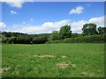
Grass field near Mitcheldean
Borders on to the grounds of Dene Magna School.
Image: © Jonathan Thacker
Taken: 15 Jun 2017
0.09 miles
3
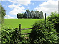
Hillside and stile
Below Dene Magna School.
Image: © Jonathan Thacker
Taken: 15 Jun 2017
0.12 miles
5
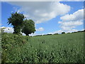
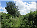
Footpath to Barton Hill
But almost impossible to follow along the edge of this field of oats.
Image: © Jonathan Thacker
Taken: 15 Jun 2017
0.16 miles
6
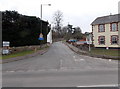
Abenhall Road, Mitcheldean
Abenhall Road heads away from the A4136 Gloucester Road, past the Lamb Inn. http://www.geograph.org.uk/photo/3344692
On the left, signs pointing along Abenhall Road show that this is the way to:
Dene Magna Community School,
Abenhall (½ mile),
Gunn Mill Guesthouse (1¾ miles),
Flaxley (3 miles) and Westbury-on-Severn (5 miles).
Image: © Jaggery
Taken: 24 Feb 2013
0.18 miles
7
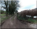
Track beyond Baby Lane, Mitcheldean
Baby Lane http://www.geograph.org.uk/photo/3347554 behind the camera becomes this track ahead.
The Anns Walk name sign is for the right turn into this http://www.geograph.org.uk/photo/3347720 private road.
Image: © Jaggery
Taken: 24 Feb 2013
0.18 miles
8
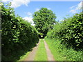
Track running into Silver Street, Mitcheldean
Image: © Jonathan Thacker
Taken: 15 Jun 2017
0.18 miles
9
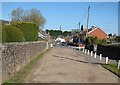
Baby Lane, Mitcheldean
The cars are parked in Silver Street. In the distance the spire of St. Michael and All Angels Church provides a familiar landmark.
Image: © Pauline E
Taken: 27 Mar 2008
0.18 miles
10
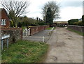
Baby Lane, Mitcheldean
The name sign on the left, at the southern end of Silver Street, shows Baby Lane.
I wondered whether this unusual name is unique in the UK, but it's not.
There is at least one other Baby Lane. This one http://www.geograph.org.uk/photo/2575314 is in Suffolk.
Image: © Jaggery
Taken: 24 Feb 2013
0.18 miles