
IMAGES TAKEN NEAR TO
New Road, MITCHELDEAN, GL17 0BX
Introduction
This page details the photographs taken nearby to New Road, GL17 0BX by members of the Geograph project.
The Geograph project started in 2005 with the aim of publishing, organising and preserving representative images for every square kilometre of Great Britain, Ireland and the Isle of Man.

There are currently over 7.5m images from over14,400 individuals and you can help contribute to the project by visiting https://www.geograph.org.uk
Image Map
Images are licensed for reuse under creativecommons.org/licenses/by-sa/2.0
Notes
- Clicking on the map will re-center to the selected point.
- The higher the marker number, the further away the image location is from the centre of the postcode.
Image Listing (122 Images Found)
Images are licensed for reuse under creativecommons.org/licenses/by-sa/2.0
Image
Details
Distance
1
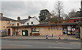
The Old Smithy Stores, Mitcheldean
Viewed across the A4136 New Road. The Old Smithy Stores carries the symbol of Premier, a major UK symbol group with more than 2,400 stores nationwide. Each store is owned by the individual retailer, not by Premier. Premier's role is to supply the stores with stock, which includes well-known brand names available elsewhere, and Premier's own brands, Euro Shopper, Happy Shopper, Farm Fresh and Butcher's Market.
Image: © Jaggery
Taken: 24 Feb 2013
0.01 miles
2
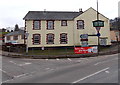
The Lamb Inn, Mitcheldean
This view is of the Gloucester Road and Abenhall Road corner of the inn.
The inn also has a frontage along New Road. http://www.geograph.org.uk/photo/3347403
Image: © Jaggery
Taken: 24 Feb 2013
0.01 miles
3
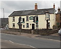
New Road side of The Lamb Inn, Mitcheldean
The large inn also has a frontage along Abenhall Road. http://www.geograph.org.uk/photo/3344692
Image: © Jaggery
Taken: 24 Feb 2013
0.02 miles
4
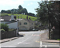
The Lamb Inn, Mitcheldean
Mid 19th century building.
Image: © Pauline E
Taken: 25 Aug 2007
0.02 miles
5
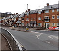
New houses on New Road, Mitcheldean
Viewed from alongside the mini-roundabout at the junction of the A4136, B4224 Hawker Hill and Abenhall Road. The houses in view are part of a large area of recently-built houses in Mitcheldean.
Image: © Jaggery
Taken: 24 Feb 2013
0.02 miles
6
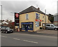
Forest Fish 'N' Chips, Mitcheldean
Located in New Road, next door to Mitcheldean Garage. http://www.geograph.org.uk/photo/3347494 The name board shows
Forest Fish 'N' Chips and Raj Indian Takeaway.
Yellow lettering on the windows shows FRESHLY MADE PIZZA HERE.
Image: © Jaggery
Taken: 24 Feb 2013
0.03 miles
7
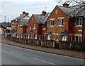
The Merrin, Mitcheldean
Houses in this part of The Merrin are alongside the B4224 Hawker Hill. Other houses in The Merrin are alongside the A4136 New Road, or set back from the west side of the road.
Image: © Jaggery
Taken: 24 Feb 2013
0.03 miles
8
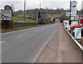
NE boundary of Mitcheldean
The A4136 Gloucester Road approaches the boundary sign for Mitcheldean,
a small town at the eastern edge of the Forest of Dean in Gloucestershire.
Image: © Jaggery
Taken: 24 Feb 2013
0.03 miles
9
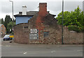
Toll House, Gloucester Road
A Toll House, now an extension of Forest House. At the junction of Gloucester Road, Merrin Street, New Road and Abbenhall Road. Served Huntley and Mitcheldean Turnpike Trust.
In the wall next to the lamppost is the milestone see Image Gloucestershire HER Nᴼ. 5863 see https://www.heritagegateway.org.uk/Gateway/Results_Single.aspx?uid=5863&resourceID=108
Milestone Society National ID: GL.MDE01
Image: © Mr Red
Taken: 23 May 2022
0.03 miles
10
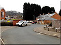
The Merrin, Mitcheldean
The Merrin is a cul-de-sac on the north side of the A4136 New Road.
Image: © Jaggery
Taken: 24 Feb 2013
0.03 miles