IMAGES TAKEN NEAR TO
Townsend, MITCHELDEAN, GL17 0BE

Introduction

This page details the photographs taken nearby to Townsend, GL17 0BE by members of the Geograph project.

The Geograph project started in 2005 with the aim of publishing, organising and preserving representative images for every square kilometre of Great Britain, Ireland and the Isle of Man.

There are currently over 7.5m images from over14,400 individuals and you can help contribute to the project by visiting https://www.geograph.org.uk

Image Map


Images are licensed for reuse under creativecommons.org/licenses/by-sa/2.0
Notes
  • Clicking on the map will re-center to the selected point.
  • The higher the marker number, the further away the image location is from the centre of the postcode.

Image Listing (93 Images Found)

Images are licensed for reuse under creativecommons.org/licenses/by-sa/2.0
  • ...
Image
Details
Distance
1
Toll House, Townend
The Old Pike House in Mitcheldean on the B4224. Originally guarding the Mitcheldean to Lea Turnpike, opened in 1769. Served Huntley and Mitcheldean Turnpike Trust. Milestone Society National ID: GL.MDE02
Image: © Mr Red Taken: 23 May 2022
0.03 miles
2
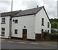
Townsend houses in Mitcheldean
Houses on the west side of the B4224 Townsend, north of Churchill Way and Court Farm Lane.
Image: © Jaggery Taken: 24 Feb 2013
0.04 miles
3
Corner of Old Dean Road, Mitcheldean
The road to the left is the old Mitcheldean to Lea road.
Image: © Jonathan Billinger Taken: 10 Nov 2019
0.06 miles
4
Court Farm Lane, Mitcheldean
The footpath heading off to the right is squeezed in between two houses.
Image: © Pauline E Taken: 25 Aug 2007
0.08 miles
5
Town Hall, Mitcheldean
Listed Grade II.
Image: © Chris Allen Taken: 28 Aug 2021
0.09 miles
6
A small, but perfectly formed Town Hall
Built in 1710 at the junction of Townsend and Court Farm Lane.
Image: © Pauline E Taken: 25 Aug 2007
0.09 miles
7
Archway Court, High Street, Mitcheldean
Archway Court is a Wyedean Housing Association property of 10 flats for the elderly.
Image: © Jaggery Taken: 24 Feb 2013
0.09 miles
8
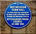
Town hall blue plaque, Mitcheldean
On the wall here. http://www.geograph.org.uk/photo/3854102
Image: © Jaggery Taken: 24 Feb 2013
0.09 miles
9
White Horse, Mitcheldean
The High Street pub was formerly named the White Horse Hotel.
Image: © Jaggery Taken: 24 Feb 2013
0.09 miles
10
Junction of Townsend and Court Farm Lane
Image: © Pauline E Taken: 25 Aug 2007
0.09 miles
  • ...