
IMAGES TAKEN NEAR TO
The Gorse, COLEFORD, GL16 8QE
Introduction
This page details the photographs taken nearby to The Gorse, GL16 8QE by members of the Geograph project.
The Geograph project started in 2005 with the aim of publishing, organising and preserving representative images for every square kilometre of Great Britain, Ireland and the Isle of Man.

There are currently over 7.5m images from over14,400 individuals and you can help contribute to the project by visiting https://www.geograph.org.uk
Image Map
Images are licensed for reuse under creativecommons.org/licenses/by-sa/2.0
Notes
- Clicking on the map will re-center to the selected point.
- The higher the marker number, the further away the image location is from the centre of the postcode.
Image Listing (35 Images Found)
Images are licensed for reuse under creativecommons.org/licenses/by-sa/2.0
Image
Details
Distance
1
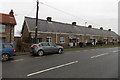
Gorse Bungalows, Coleford
Viewed across The Gorse. The 50 metre long row has 10 houses and 5 front doors. Each doorway has a different house number on each side. Presumably behind each street door there is an entrance hall leading to the two house doors.
Image: © Jaggery
Taken: 23 Nov 2014
0.00 miles
2
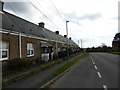
Gorse bungalows, Coleford
A row of almshouses built at the end of the 19th century. They were built as free housing for 5 men and 5 women living within 2 miles of Coleford Baptists Church.
Image: © Eirian Evans
Taken: 17 Sep 2015
0.01 miles
3
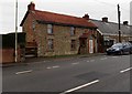
Little Gorse House, Coleford
Viewed across The Gorse in the north of Coleford. Gorse Bungalows http://www.geograph.org.uk/photo/4258434 are on the right.
Image: © Jaggery
Taken: 23 Nov 2014
0.03 miles
4
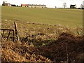
View near Berry Hill
Looking across a field from close to the spot where Image was taken, with Gorse Bungalows along the hilltop road between Berry Hill and Coleford.
Image: © Derek Harper
Taken: 2 Feb 2010
0.05 miles
5
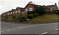
Lark Rise bungalows, Coleford
Bungalows on the north side of Lark Rise, viewed across The Gorse.
Image: © Jaggery
Taken: 23 Nov 2014
0.07 miles
6
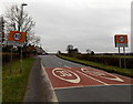
Wonky speed limit sign, Coleford
In contrast with the sign on the right, the one of the left, showing Please drive carefully, is no longer properly aligned, perhaps the result of a collision following an absence of careful driving.
This is not a town boundary. The northern boundary sign http://www.geograph.org.uk/photo/4258441 is about 250 metres to the north.
Image: © Jaggery
Taken: 23 Nov 2014
0.08 miles
7
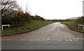
Entrance drive to Great Oaks Hospice, Coleford
On each side of the drive, signs similar to street name signs show GREAT OAKS HOSPICE.
Viewed from the main road, The Gorse.
Image: © Jaggery
Taken: 23 Nov 2014
0.11 miles
8
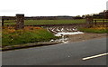
Muddy field entrance from The Gorse, Coleford
Viewed in late November 2014, a time of year when daylight duration is only about half the midsummer duration and evaporation is usually low. However, high summer is no guarantee of a dry entrance.
A Google Earth Street View taken during the wet July 2009 shows a similar scene, slightly less muddy.
Image: © Jaggery
Taken: 23 Nov 2014
0.12 miles
9
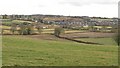
Valley north of Coleford
A similar view to Image, but taken further northeast from the A4136 (Lower Road). As explained at http://www.british-history.ac.uk/report.aspx?compid=23255 , several brooks join to form Valley Brook, the main stream through the town of Coleford, but the stream from this valley does not seem to be mentioned. The northeast edges of Coleford in the background, around Baker's Hill and Poolway, are mainly in Image
Image: © Derek Harper
Taken: 2 Feb 2010
0.13 miles
10
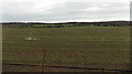
Standing water on a field west of The Gorse, Coleford
Patchy standing water in late November 2014.
Image: © Jaggery
Taken: 23 Nov 2014
0.13 miles