
IMAGES TAKEN NEAR TO
Newland, COLEFORD, GL16 8NG
Introduction
This page details the photographs taken nearby to GL16 8NG by members of the Geograph project.
The Geograph project started in 2005 with the aim of publishing, organising and preserving representative images for every square kilometre of Great Britain, Ireland and the Isle of Man.

There are currently over 7.5m images from over14,400 individuals and you can help contribute to the project by visiting https://www.geograph.org.uk
Image Map
Images are licensed for reuse under creativecommons.org/licenses/by-sa/2.0
Notes
- Clicking on the map will re-center to the selected point.
- The higher the marker number, the further away the image location is from the centre of the postcode.
Image Listing (6 Images Found)
Images are licensed for reuse under creativecommons.org/licenses/by-sa/2.0
Image
Details
Distance
1
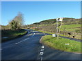
Road junction near Scatterford Farm, Newland
Image: © Ruth Sharville
Taken: 11 Jan 2014
0.03 miles
2
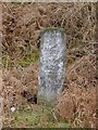
Old Milestone north of Scatterford Farm, Newland Parish
Carved stone post by the UC road, in parish of NEWLAND (FOREST OF DEAN District), 100m North of road junction to Coleford, on grass verge, on South West side of road. MOCO erected by the Bigswear turnpike trust in the 19th century.
Inscription reads:-
GLO'STER
21
MILES
TO
LONDON
126
Carved benchmark on front.
Gloucestershire County Council HER.
Monument Number: 6069 https://www.heritagegateway.org.uk/Gateway/Results_Single.aspx?uid=6069&resourceID=108
Milestone Society National ID: GL_MOCO5.
Image: © K Walker & R Harvey
Taken: 6 Mar 2004
0.08 miles
3
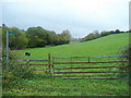
Footpath in the Clearwell Valley
Looking south-east from near Millend Farm.
Image: © Jonathan Billinger
Taken: 29 Oct 2010
0.09 miles
4
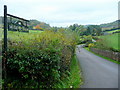
Road to Millend Farm
Set in the Newland Valley in the west of the Forest of Dean District.
Image: © Jonathan Billinger
Taken: 29 Oct 2010
0.16 miles
5
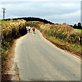
Cycling out of Clearwell
Two Sunday cyclists head towards Millend.
Image: © Jaggery
Taken: 22 Mar 2015
0.23 miles
6
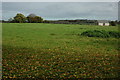
Farmland near Clearwell
Farmland and a converted barn to the west of Clearwell.
Image: © Philip Halling
Taken: 30 Oct 2010
0.24 miles