
IMAGES TAKEN NEAR TO
Victoria Gardens, COLEFORD, GL16 8DX
Introduction
This page details the photographs taken nearby to Victoria Gardens, GL16 8DX by members of the Geograph project.
The Geograph project started in 2005 with the aim of publishing, organising and preserving representative images for every square kilometre of Great Britain, Ireland and the Isle of Man.

There are currently over 7.5m images from over14,400 individuals and you can help contribute to the project by visiting https://www.geograph.org.uk
Image Map
Images are licensed for reuse under creativecommons.org/licenses/by-sa/2.0
Notes
- Clicking on the map will re-center to the selected point.
- The higher the marker number, the further away the image location is from the centre of the postcode.
Image Listing (218 Images Found)
Images are licensed for reuse under creativecommons.org/licenses/by-sa/2.0
Image
Details
Distance
1
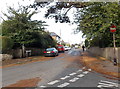
Bowens Hill Road, Coleford
Viewed from the corner of Boxbush Road looking towards Victoria Road.
Image: © Jaggery
Taken: 12 Oct 2014
0.07 miles
2
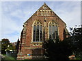
The former church of St. John the Evangelist, Coleford
Now closed. Anglican services are held at the Roman Catholic church in the town. https://historicengland.org.uk/listing/the-list/list-entry/1211330
Image: © Jonathan Thacker
Taken: 12 Sep 2018
0.09 miles
3
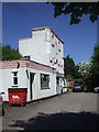
Rock Castle, Coleford
Now a dental surgery
Image: © John Lord
Taken: 24 May 2010
0.10 miles
4
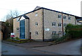
Commercial site for sale or to let, Coleford
Located alongside Newland Street on the NE side of a disused railway bridge.
Image: © Jaggery
Taken: 12 Dec 2011
0.10 miles
5
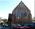
Western side of the church of St John the Evangelist, Coleford
Viewed from Boxbush Road. A large board outside the church shows that it is part of the Mid-Wyedean group of churches. This church was built in 1882 to replace the church in the centre of Coleford.
A tower http://www.geograph.org.uk/photo/3257681 is all the remains of the earlier church. This church does not have a tower perhaps because, one commentator wryly observed, one tower is enough for Coleford.
Image: © Jaggery
Taken: 12 Dec 2011
0.10 miles
6
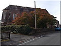
St John the Evangelist, Coleford
Viewed from Boxbush Road. A large board outside the church shows that it is part of the Mid-Wyedean group of churches. The church was built in 1882 to replace the church in the centre of Coleford.
A tower http://www.geograph.org.uk/photo/3257681 is all the remains of the earlier church. This church does not have a tower perhaps because, one commentator wryly observed, one tower is enough for Coleford.
Image: © Jaggery
Taken: 12 Oct 2014
0.10 miles
7
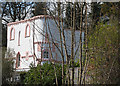
A pink and white confection
This house in Newland Street resembles a giant cake.
Image: © Pauline E
Taken: 15 Apr 2008
0.10 miles
8
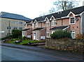
Newland Street houses, Coleford
The building in the background http://www.geograph.org.uk/photo/3258026 is part of a commercial site.
Image: © Jaggery
Taken: 12 Dec 2011
0.11 miles
9
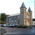
Corner view of Coleford Baptist Church
Viewed across Newland Street. The first record of Baptists worshipping in Coleford was in 1805.
This church was built in 1858, and extended in 1889 with the addition of school rooms.
http://www.geograph.org.uk/photo/3257986 to a front view.
Image: © Jaggery
Taken: 12 Dec 2011
0.11 miles
10
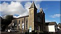
Coleford Baptist Church, Newland Street
My parents were married here in 1960. The building was designed by Charles Grey Searle of London who was fond of this symmetrical kind of street frontage, a gable flanked by towers or spires. Witness his Baptist church in Hampstead (where, coincidentally, my parents met each other) Image or Trinity United Reformed in High Wycombe Image
Image: © Chris Brown
Taken: 22 Mar 2017
0.11 miles