1
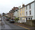
Into the fog along Albert Road, Coleford
Viewed from near the Oakfields junction on an October morning of patchy fog.
Image: © Jaggery
Taken: 12 Oct 2014
0.08 miles
2
Bowens Hill Road, Coleford
Viewed from the corner of Boxbush Road looking towards Victoria Road.
Image: © Jaggery
Taken: 12 Oct 2014
0.08 miles
3
Victoria Road, Coleford
Viewed from the Staunton Road end looking SW on a foggy October morning.
Image: © Jaggery
Taken: 12 Oct 2014
0.11 miles
4
Road from Coleford to Staunton and Monmouth
Staunton Road (B4228) climbs away from central Coleford towards the A4136 which it meets about a mile away, at Robin Hood junction. Turn right 100 metres ahead for Ross-on-Wye, Symonds Yat and Berry Hill.
Image: © Jaggery
Taken: 12 Dec 2011
0.12 miles
5
The former church of St. John the Evangelist, Coleford
Now closed. Anglican services are held at the Roman Catholic church in the town. https://historicengland.org.uk/listing/the-list/list-entry/1211330
Image: © Jonathan Thacker
Taken: 12 Sep 2018
0.13 miles
6
St John the Evangelist, Coleford
Viewed from Boxbush Road. A large board outside the church shows that it is part of the Mid-Wyedean group of churches. The church was built in 1882 to replace the church in the centre of Coleford.
A tower http://www.geograph.org.uk/photo/3257681 is all the remains of the earlier church. This church does not have a tower perhaps because, one commentator wryly observed, one tower is enough for Coleford.
Image: © Jaggery
Taken: 12 Oct 2014
0.13 miles
7
Western side of the church of St John the Evangelist, Coleford
Viewed from Boxbush Road. A large board outside the church shows that it is part of the Mid-Wyedean group of churches. This church was built in 1882 to replace the church in the centre of Coleford.
A tower http://www.geograph.org.uk/photo/3257681 is all the remains of the earlier church. This church does not have a tower perhaps because, one commentator wryly observed, one tower is enough for Coleford.
Image: © Jaggery
Taken: 12 Dec 2011
0.13 miles
8
Boxbush Road, Coleford
A view SW from near this converted former chapel. http://www.geograph.org.uk/photo/3257408
Image: © Jaggery
Taken: 11 Dec 2011
0.15 miles
9
Oakfields, Coleford
Viewed from Albert Road. Oakfields leads to Meads Close. http://www.geograph.org.uk/photo/4203218
Image: © Jaggery
Taken: 12 Oct 2014
0.15 miles
10
Rock Castle, Coleford
Now a dental surgery
Image: © John Lord
Taken: 24 May 2010
0.15 miles


