
IMAGES TAKEN NEAR TO
Greenfield Road, COLEFORD, GL16 8BY
Introduction
This page details the photographs taken nearby to Greenfield Road, GL16 8BY by members of the Geograph project.
The Geograph project started in 2005 with the aim of publishing, organising and preserving representative images for every square kilometre of Great Britain, Ireland and the Isle of Man.

There are currently over 7.5m images from over14,400 individuals and you can help contribute to the project by visiting https://www.geograph.org.uk
Image Map
Images are licensed for reuse under creativecommons.org/licenses/by-sa/2.0
Notes
- Clicking on the map will re-center to the selected point.
- The higher the marker number, the further away the image location is from the centre of the postcode.
Image Listing (34 Images Found)
Images are licensed for reuse under creativecommons.org/licenses/by-sa/2.0
Image
Details
Distance
1
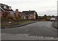
Coombs Road, Coleford
Looking east from The Gorse.
Image: © Jaggery
Taken: 23 Nov 2014
0.06 miles
2

Access road to Great Oaks Hospice, Coleford
The building in the background on the right is set back c150 metres from the main road, The Gorse.
Image: © Jaggery
Taken: 23 Nov 2014
0.08 miles
3
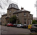
The Coombs, Coleford
Set back from The Gorse, Grade II listed The Coombs was built c1859
as a residence for the Trotter family of Coleford. It is now a care home.
Image: © Jaggery
Taken: 23 Nov 2014
0.09 miles
4
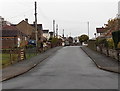
Park Road, Coleford
Looking north from Orchard Road. The Grove Crescent junction is opposite the car.
Image: © Jaggery
Taken: 23 Nov 2014
0.10 miles
5
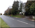
Entrance to The Coombs, Coleford
From The Gorse. The Coombs care home http://www.geograph.org.uk/photo/4258412 is Grade II listed.
Image: © Jaggery
Taken: 23 Nov 2014
0.11 miles
6
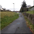
Concrete post, Sparrow Hill, Coleford
At the northern end of Sparrow Hill, near The Gorse junction,
the post prevents the passage of motor vehicles.
Image: © Jaggery
Taken: 23 Nov 2014
0.12 miles
7
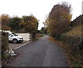
Sparrow Hill north of Orchard Road, Coleford
This is not a through route for motor vehicles - a concrete post http://www.geograph.org.uk/photo/4257164 blocks
the road out of shot ahead, though that is no barrier for walkers or cyclists.
Image: © Jaggery
Taken: 23 Nov 2014
0.12 miles
8
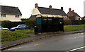
Bus shelter and litter bin, The Gorse, Coleford
Located between The Gorse (the main road) on this side and houses in Sunnybank Road.
Image: © Jaggery
Taken: 23 Nov 2014
0.13 miles
9
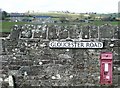
Beyond the interesting wall
Do you focus on the variety of things on the wall? Or do you gaze over the wall to the farm in the next square?
Image: © Graham Horn
Taken: 27 Mar 2008
0.13 miles
10
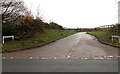
Entrance drive to Great Oaks Hospice, Coleford
On each side of the drive, signs similar to street name signs show GREAT OAKS HOSPICE.
Viewed from the main road, The Gorse.
Image: © Jaggery
Taken: 23 Nov 2014
0.13 miles