
IMAGES TAKEN NEAR TO
Station Road, COLEFORD, GL16 7LJ
Introduction
This page details the photographs taken nearby to Station Road, GL16 7LJ by members of the Geograph project.
The Geograph project started in 2005 with the aim of publishing, organising and preserving representative images for every square kilometre of Great Britain, Ireland and the Isle of Man.

There are currently over 7.5m images from over14,400 individuals and you can help contribute to the project by visiting https://www.geograph.org.uk
Image Map
Images are licensed for reuse under creativecommons.org/licenses/by-sa/2.0
Notes
- Clicking on the map will re-center to the selected point.
- The higher the marker number, the further away the image location is from the centre of the postcode.
Image Listing (61 Images Found)
Images are licensed for reuse under creativecommons.org/licenses/by-sa/2.0
Image
Details
Distance
1
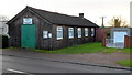
Milkwall Village Hall
The 20 metre long wooden building is on the south side of Station Road. It was originally an army hut dating from 1926. The building contains a hall with a capacity of 70 and one meeting room.
Image: © Jaggery
Taken: 12 Dec 2011
0.01 miles
2

Track alongside the village hall, Milkwall
The track is on the east side of the hall.http://www.geograph.org.uk/photo/3260682
A notice stapled to the wooden wall informs you that you are now entering land owned by
Milkwall & District Recreational Hall. Please pick up after your dog and leave the area clean.
Image: © Jaggery
Taken: 12 Dec 2011
0.01 miles
3
KWT Coaches, Milkwall
Coaches for hire in Station Road.
Image: © Pauline E
Taken: 12 Jun 2008
0.05 miles
4
Primrose Drive, Milkwall
Viewed from the Station Road end. In the middle distance, posts mark the location of a cattle grid across the road. Primrose Drive is a cul-de-sac with branches to four short cul-de-sacs,
Bluebell Close, Clover Close, Foxglove Way and Bramble Road.
Image: © Jaggery
Taken: 12 Dec 2011
0.05 miles
5
Station Road Garage, Milkwall
Premises of Brian J.Aston coach and bus hire.
Image: © Jaggery
Taken: 12 Dec 2011
0.05 miles
6
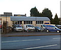
Stepbridge Van Sales, Milkwall
Stepbridge Van Sales & vehicle services is located in Nash & Cox Yard on the north side of Station Road.
Image: © Jaggery
Taken: 12 Dec 2011
0.06 miles
7
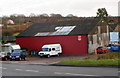
Red corrugated building, Milkwall
Viewed across Station Road. The name on the board on the right is P J Engineering.
Image: © Jaggery
Taken: 12 Dec 2011
0.07 miles
8
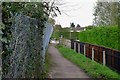
Site of Milkwall station from the trackbed
The road in the background used to cross the railway on a girder bridge, demolished some time in the 1970s after the line closed. Milkwall station platform, complete with rather ugly brick building (a replacement for the original wooden station building which was unpopular with passengers and which mysteriously "went on fire" in 1923 ... oddly, a similar fate had befallen the equally unpopular wooden station building at Coleford five years earlier) was where the fence is now. This was also the site of the junction for the Sling branch which was under a mile long and served Fred Watkins' engineering works at Sling.
Image: © John Winder
Taken: 5 Oct 2019
0.08 miles
9
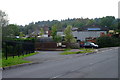
Site of Milkwall station
The Severn & Wye Joint Railway's Coleford branch - now a footpath and cycle track - ran from left to right towards Coleford. In the centre of the photo, where the wooden fence is, was Milkwall station, which lost its passenger service with the rest of the S&WJR system in 1929. Threading through the industrial buildings in the background was the Sling branch, which was under a mile long and was converted from a tramway in 1876 by the S&WJR using money loaned to them by W. H. Fryer, a local ironworks owner, on the understanding that until the loan was repaid his traffic would be carried for free or at reduced rates. The last train ran on the Sling branch on December 31st 1965, although it was only officially closed with the Coleford line in August 1967. Information in this caption is mostly from Neil Parkhouse's excellent book "Forest of Dean Lines and the Severn Bridge" from the "British Railway History in Colour" series. The book also contains a 1965 photo taken from the same viewpoint as my picture.
Image: © John Winder
Taken: 5 Oct 2019
0.08 miles
10
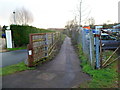
Path on the route of a former railway, Milkwall
Viewed from the location of the former Milkwall railway station on the Severn & Wye Railway.
The station opened in 1853. Passenger services ceased here in 1929.
Station House http://www.geograph.org.uk/photo/3260824 is on the left.
Image: © Jaggery
Taken: 12 Dec 2011
0.08 miles