
IMAGES TAKEN NEAR TO
Holcot Road, COLEFORD, GL16 7HH
Introduction
This page details the photographs taken nearby to Holcot Road, GL16 7HH by members of the Geograph project.
The Geograph project started in 2005 with the aim of publishing, organising and preserving representative images for every square kilometre of Great Britain, Ireland and the Isle of Man.

There are currently over 7.5m images from over14,400 individuals and you can help contribute to the project by visiting https://www.geograph.org.uk
Image Map
Images are licensed for reuse under creativecommons.org/licenses/by-sa/2.0
Notes
- Clicking on the map will re-center to the selected point.
- The higher the marker number, the further away the image location is from the centre of the postcode.
Image Listing (50 Images Found)
Images are licensed for reuse under creativecommons.org/licenses/by-sa/2.0
Image
Details
Distance
1
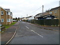
Holcot Road, Coleford
Viewed from the Coalway Road end. Holcot Road is a few tens of metres
on the Coleford side of the boundary with Coalway.
Image: © Jaggery
Taken: 11 Dec 2011
0.01 miles
2

Coalway
One of the satellite villages of Coleford.
Image: © Stuart Wilding
Taken: 25 Feb 2006
0.07 miles
3

Looking across Coalway Road
View from near Golf Course, looking across Coalway Road on outskirts of Coleford. Large house opposite is called 'Kinver'.
Image: © Clint Mann
Taken: 11 May 2011
0.08 miles
4

SE boundary of Coleford
Coalway Road leaves Coalway and enters Coleford, a small market town in the Forest of Dean, Gloucestershire. The town's population on the day of the 2001 Census was 8,351.
Image: © Jaggery
Taken: 11 Dec 2011
0.09 miles
5
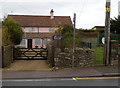
Meadow Cottage, Coalway
The cottage is set back 30 metres from the north side of Coalway Road.
Image: © Jaggery
Taken: 11 Dec 2011
0.09 miles
6
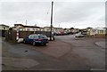
Coalway Park houses, Coalway
Viewed from New Road. Coalway Park contains several dozen park homes, which are modern, bungalow-style residential properties, sometimes referred to as mobile homes.
Image: © Jaggery
Taken: 11 Dec 2011
0.10 miles
7

Access lane to Edenwall Farm, Coleford
Viewed across Coalway Road from the corner of Holcot Road. http://www.geograph.org.uk/photo/3240959
Image: © Jaggery
Taken: 11 Dec 2011
0.10 miles
8
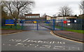
Coalway school entrance
The entrance to Coalway Community Infant & Junior Schools is on the north side of Coalway Road.
Image: © Jaggery
Taken: 11 Dec 2011
0.12 miles
9

Houses on Coalway Road
Houses on Coalway Road near Coleford viewed here from the edge of the golf course.
Image: © Philip Halling
Taken: 14 Oct 2012
0.12 miles
10

School entrance, Coalway
Coalway County Infant & Junior Schools.
Image: © Pauline E
Taken: 12 Jun 2008
0.12 miles