1
Former pub, Seymour Road, Gloucester
The Seymour, by J.F. Trew, 1895.
Now flats.
Image: © Stephen Richards
Taken: 18 May 2015
0.07 miles
2
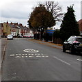
School safety zone speed limit, Linden Road, Gloucester
Viewed from near the mini-roundabout at the southern end of King Edward's Avenue.
A 20mph school safety speed limit applies ahead.
Image: © Jaggery
Taken: 13 Apr 2012
0.08 miles
3
Purple house in a Gloucester suburb
Viewed across Linden Road.
Image: © Jaggery
Taken: 6 Nov 2016
0.17 miles
4
Linden Road towards Linden Primary School, Gloucester
Part of a School Safety Zone where the speed limit is 20mph.
Image: © Jaggery
Taken: 6 Nov 2016
0.17 miles
5
Linden Road School Safety Zone, Gloucester
A 20mph speed limit is in force on the approach to Linden Primary School.
Image: © Jaggery
Taken: 6 Nov 2016
0.17 miles
6
67-113 Seymour Road, Gloucester
Typical artisan housing of the last decades of the C19th.
Image: © Stephen Richards
Taken: 18 May 2015
0.18 miles
7
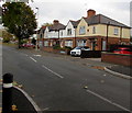
King Edward's Avenue houses, Gloucester
Viewed from the corner of Linden Road.
Image: © Jaggery
Taken: 6 Nov 2016
0.19 miles
8
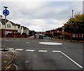
White painted roundabout at a suburban crossroads, Gloucester
At the crossroads of Linden Road (camera side and ahead),
The Oval on the right and King Edward's Avenue on the left.
Image: © Jaggery
Taken: 6 Nov 2016
0.19 miles
9
Warning sign - humps for 400 yards, The Oval, Gloucester
Facing the Linden Road junction, the sign is alongside the road named The Oval.
Image: © Jaggery
Taken: 6 Nov 2016
0.20 miles
10
Gloucester, St. Stephen's
Former Anglican parish church on Bristol Road; closed in 2010: http://churchdb.gukutils.org.uk/GLS267.php https://www.gloucestershirelive.co.uk/whats-on/music-nightlife/could-become-gloucesters-next-new-1393965
Image: © Mike Faherty
Taken: 12 Oct 2018
0.20 miles


