IMAGES TAKEN NEAR TO
The Common, LYDNEY, GL15 6SW
Introduction
This page details the photographs taken nearby to The Common, GL15 6SW by members of the Geograph project.
The Geograph project started in 2005 with the aim of publishing, organising and preserving representative images for every square kilometre of Great Britain, Ireland and the Isle of Man.

There are currently over 7.5m images from over14,400 individuals and you can help contribute to the project by visiting https://www.geograph.org.uk
Image Map
Images are licensed for reuse under creativecommons.org/licenses/by-sa/2.0
Notes
- Clicking on the map will re-center to the selected point.
- The higher the marker number, the further away the image location is from the centre of the postcode.
Image Listing (11 Images Found)
Images are licensed for reuse under creativecommons.org/licenses/by-sa/2.0
Image
Details
Distance
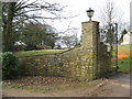
2
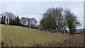
Pastoral land, St. Briavel's Common
View east towards more arable land-use.
Image: © Jonathan Billinger
Taken: 22 Feb 2013
0.14 miles
3
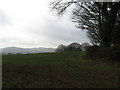
St Briavels Common
Looking out towards the Wye Valley.
Image: © Dr Duncan Pepper
Taken: 11 Mar 2011
0.16 miles
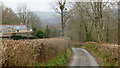
4
Offa's Dyke Path
Also a restricted byway, one of many tracks and lanes in St. Briavel's Common.
Image: © Jonathan Billinger
Taken: 22 Feb 2013
0.16 miles
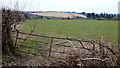
5
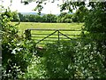
Field gateway
Field gateway near Hewelsfield Common.
Image: © Philip Halling
Taken: 2 Jun 2022
0.17 miles
6
St. Briavel's Common
Pasture land here with some old machinery and vehicles.
Image: © Jonathan Billinger
Taken: 22 Feb 2013
0.17 miles
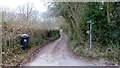
7
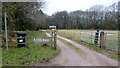
Drive and footpath
To Fayland, St. Briavel's Common.
Image: © Jonathan Billinger
Taken: 22 Feb 2013
0.18 miles
8
Farm track and footpath
Towards Hewelsfield.
Image: © Jonathan Billinger
Taken: 22 Feb 2013
0.20 miles
9
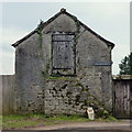
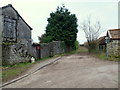
Old building at The Hawthorns
If this was in Cornwall it would now be a holiday let!
Image: © Jonathan Billinger
Taken: 22 Feb 2013
0.20 miles
10
Offa's Dyke Path LDF
Follows the road to the signpost and then turns left up hill by Dene Hurst Farm.
Image: © Jonathan Billinger
Taken: 8 Mar 2019
0.22 miles