IMAGES TAKEN NEAR TO
Perry Field, LYDNEY, GL15 6QD
Introduction
This page details the photographs taken nearby to Perry Field, GL15 6QD by members of the Geograph project.
The Geograph project started in 2005 with the aim of publishing, organising and preserving representative images for every square kilometre of Great Britain, Ireland and the Isle of Man.

There are currently over 7.5m images from over14,400 individuals and you can help contribute to the project by visiting https://www.geograph.org.uk
Image Map
Images are licensed for reuse under creativecommons.org/licenses/by-sa/2.0
Notes
- Clicking on the map will re-center to the selected point.
- The higher the marker number, the further away the image location is from the centre of the postcode.
Image Listing (46 Images Found)
Images are licensed for reuse under creativecommons.org/licenses/by-sa/2.0
Image
Details
Distance

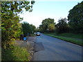

4
Woolaston boundary sign
The boundary sign is located NW of the A48, between the turnings for Perry Field behind the camera and Ashway ahead. Confusingly, for this visitor at least, the sign shows Woolaston but the area ahead is Netherend. The explanation is that Woolaston is both a village and a civil parish (in the Forest of Dean district of Gloucestershire). Netherend is part of the civil parish of Woolaston, which also includes many other hamlets and small villages, including Stroat, Woolaston Common, High Woolaston, Woolaston Woodside and Woolaston Slade.
Image: © Jaggery
Taken: 18 Nov 2012
0.02 miles
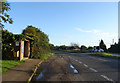
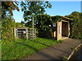
6
Bus shelter by A48 for Woolaston Court bus stop
There is a footpath across the field to Netherend
Image: © David Smith
Taken: 3 Aug 2018
0.06 miles
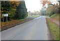
8
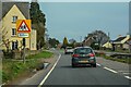
Woolaston : Main Road A48
Looking along the A48.
Image: © Lewis Clarke
Taken: 22 Mar 2023
0.06 miles
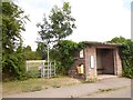
9
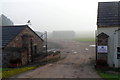
No dogs allowed in Woolaston Court Trout Lakes
A view from the edge of the A48 about 3 miles SW of Lydney. The fishery is near Cone Brook.
http://www.geograph.org.uk/photo/3230626 to a nearby view.
Image: © Jaggery
Taken: 18 Nov 2012
0.07 miles
10
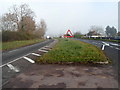
1 in 10 descent ahead into Alvington
A view along the A48 near the entrance to Woolaston Court Trout Lakes. http://www.geograph.org.uk/photo/3230626
The sign shows a 10% descent ahead, which is the same as 1 in 10.
Image: © Jaggery
Taken: 18 Nov 2012
0.07 miles