
IMAGES TAKEN NEAR TO
Highbury Road, LYDNEY, GL15 6EG
Introduction
This page details the photographs taken nearby to Highbury Road, GL15 6EG by members of the Geograph project.
The Geograph project started in 2005 with the aim of publishing, organising and preserving representative images for every square kilometre of Great Britain, Ireland and the Isle of Man.

There are currently over 7.5m images from over14,400 individuals and you can help contribute to the project by visiting https://www.geograph.org.uk
Image Map
Images are licensed for reuse under creativecommons.org/licenses/by-sa/2.0
Notes
- Clicking on the map will re-center to the selected point.
- The higher the marker number, the further away the image location is from the centre of the postcode.
Image Listing (53 Images Found)
Images are licensed for reuse under creativecommons.org/licenses/by-sa/2.0
Image
Details
Distance
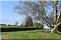
1
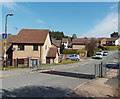
Maypole Road, Bream
Viewed from the B4231 Lydney Road. Across the road is a grid which functions most often as a sheep grid. A few minutes after taking this view, I saw these sheep http://www.geograph.org.uk/photo/3447020 in nearby High Street.
Image: © Jaggery
Taken: 6 May 2013
0.14 miles
2
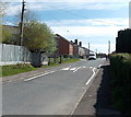
Highbury Road, Bream
A view eastwards from the corner of High Street.
Image: © Jaggery
Taken: 6 May 2013
0.14 miles
3
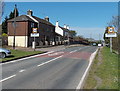
Start of the 30mph zone in Bream
The B4231 from Lydney passed the Bream boundary sign http://www.geograph.org.uk/photo/3446680 about 700 metres behind the camera.
These are the first roadside houses on the south side of the village, so the National Speed Limit reduces to 30mph ahead.
Image: © Jaggery
Taken: 6 May 2013
0.16 miles
4
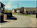
High Beech Road bungalows, Bream
Fryday's Fish & Chips shop http://www.geograph.org.uk/photo/3470768 is on the left.
Image: © Jaggery
Taken: 6 May 2013
0.17 miles
6
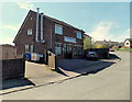
Fryday's Traditional Fish & Chips, Bream
Located in High Beech Road, near High Street.
Image: © Jaggery
Taken: 6 May 2013
0.18 miles
7
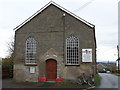
Victory Church, Bream
Churches and chapels (no 44). This chapel has a varied history. It was built as a Wesleyan Chapel in 1860. It became part of the Methodist Church in 1932, closed in 1959 and was used by a pentecostalist church in 1992. It became home to the Victory Church in 2010.
Image: © Andy Stott
Taken: 9 Nov 2013
0.20 miles
8
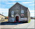
Victory Church, Bream
Viewed across Brockhollands Road. The church used to be the Christian Gospel Church.
The inscription on the tablet on the wall shows WESLEYAN CHAPEL 1860.
Image: © Jaggery
Taken: 6 May 2013
0.20 miles
10
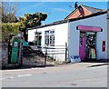
Uniqueness Therapy, Bream
Located in single-storey premises adjoining Bream Post Office. http://www.geograph.org.uk/photo/3789279 The name board shows Hair Design - Holistic Therapies. The premises were formerly occupied by Forest of Dean Gallery.
The remains of a long disused fuel pump are on the left.
Image: © Jaggery
Taken: 6 May 2013
0.20 miles