1
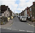
Queen Street, Lydney
The Albert Street end of a dead-end street extending for about 250 metres.
Image: © Jaggery
Taken: 16 Apr 2017
0.12 miles
2
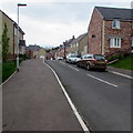
Kimberley Drive, Lydney
Kimberley Drive descends from Highfield Road towards Naas Lane.
Image: © Jaggery
Taken: 16 Apr 2017
0.13 miles
3
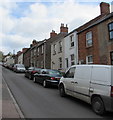
Vehicles and houses, Queen Street, Lydney
The east side of Queen Street viewed from the corner of Albert Street on Easter Sunday April 16th 2017.
Image: © Jaggery
Taken: 16 Apr 2017
0.15 miles
4
Meadow Rise, Lydney
Recently-built houses and cul-de-sac on the west side of Highfield Road, viewed in April 2017.
Image: © Jaggery
Taken: 16 Apr 2017
0.17 miles
5
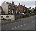
Highfield Road semis, Lydney
Semi-detached houses alongside Highfield Road between Albert Street and Meadow Rise.
Image: © Jaggery
Taken: 16 Apr 2017
0.19 miles
6
Woodland Rise, Lydney
From Albert Street, Woodland Rise ascends steeply into the Lynwood Park Estate.
Image: © Jaggery
Taken: 16 Apr 2017
0.19 miles
7
Houses on Highfield Road, Lydney
Image: © JThomas
Taken: 17 Oct 2019
0.19 miles
8
Highfield Rise, Lydney
Cul-de-sac on the east side of Highfield Road, nearly opposite Meadow Rise. http://www.geograph.org.uk/photo/5352547
Image: © Jaggery
Taken: 16 Apr 2017
0.20 miles
9
Directions sign facing Highfield Road, Lydney
On the descent to the town centre.
Image: © Jaggery
Taken: 16 Apr 2017
0.20 miles
10
Stagecoach double-decker bus descends Highfield Road, Lydney
On Easter Sunday April 16th 2017, Stagecoach bus number 15876 is on route 23 from Gloucester to Coleford via Minsterworth, Westbury-on-Severn, Newnham, Blakeney, Lydney Bus Station, Yorkley, Whitecroft, Bream, Sling and Milkwall.
Image: © Jaggery
Taken: 16 Apr 2017
0.21 miles


