IMAGES TAKEN NEAR TO
Darters Close, LYDNEY, GL15 5EY

Introduction

This page details the photographs taken nearby to Darters Close, GL15 5EY by members of the Geograph project.

The Geograph project started in 2005 with the aim of publishing, organising and preserving representative images for every square kilometre of Great Britain, Ireland and the Isle of Man.

There are currently over 7.5m images from over14,400 individuals and you can help contribute to the project by visiting https://www.geograph.org.uk

Image Map


Images are licensed for reuse under creativecommons.org/licenses/by-sa/2.0
Notes
  • Clicking on the map will re-center to the selected point.
  • The higher the marker number, the further away the image location is from the centre of the postcode.

Image Listing (452 Images Found)

Images are licensed for reuse under creativecommons.org/licenses/by-sa/2.0
  • ...
Image
Details
Distance
1
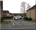
Wyntour's Parade, Lydney
From Church Road along the edge of Wyntour's Parade towards Darters Close.
Image: © Jaggery Taken: 15 Apr 2018
0.02 miles
2
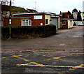
Two ambulances, Lydney
The ambulances are in Lydney Ambulance Station, set back from the north side of Church Road. The station is part of the Great Western Ambulance Service, an NHS Trust.
Image: © Jaggery Taken: 8 Feb 2013
0.03 miles
3
Tesco car park, Lydney
The Oxford Street side of the car park on the corner of High Street. This car park is for Tesco staff and visitors only. A larger Tesco car park is nearby.
Image: © Jaggery Taken: 5 Jan 2020
0.03 miles
4
Lydney Ambulance Station
Set back from the north side of Church Road, the ambulance station is part of the Great Western Ambulance Service, an NHS Trust.
Image: © Jaggery Taken: 1 Jan 2013
0.03 miles
5
Lydney Ambulance Station
Viewed across Church Road in April 2018. The name on the wall is South Western Ambulance Service NHS.
Image: © Jaggery Taken: 15 Apr 2018
0.03 miles
6
Tesco, Lydney
The town centre store occupies a large corner site (High Street and Oxford Street). The Oxford Street side, on the right is c75 metres long.
Image: © Jaggery Taken: 1 Jan 2013
0.04 miles
7
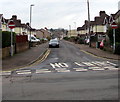
Oxford Street, Lydney
From Whitecross Road along Oxford Street towards High Street.
Image: © Jaggery Taken: 15 Apr 2018
0.04 miles
8
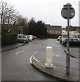
One-way signs and a speed bump, Oxford Street, Lydney
Viewed from the two-way part of Oxford Street near High Street. Ahead for Whitecross Road.
Image: © Jaggery Taken: 5 Jan 2020
0.04 miles
9
Lydney old fire station 1
Lydney old fire station 1, Oxford Street, Lydney, Gloucestershire
Image: © Kevin Hale Taken: 30 Apr 2010
0.04 miles
10
Traffic Calming, Church Road, Lydney
Also showing the Cross Keys Inn.
Image: © Pauline E Taken: 11 Oct 2007
0.04 miles
  • ...