
IMAGES TAKEN NEAR TO
Victoria Road, LYDNEY, GL15 5DG
Introduction
This page details the photographs taken nearby to Victoria Road, GL15 5DG by members of the Geograph project.
The Geograph project started in 2005 with the aim of publishing, organising and preserving representative images for every square kilometre of Great Britain, Ireland and the Isle of Man.

There are currently over 7.5m images from over14,400 individuals and you can help contribute to the project by visiting https://www.geograph.org.uk
Image Map
Images are licensed for reuse under creativecommons.org/licenses/by-sa/2.0
Notes
- Clicking on the map will re-center to the selected point.
- The higher the marker number, the further away the image location is from the centre of the postcode.
Image Listing (618 Images Found)
Images are licensed for reuse under creativecommons.org/licenses/by-sa/2.0
Image
Details
Distance
1
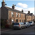
Victoria Road houses, Lydney
A view SE looking towards Bathurst Park Road.
Image: © Jaggery
Taken: 1 Jan 2013
0.01 miles
2
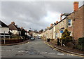
Victoria Road, Lydney
Viewed from the Bathurst Park end looking towards the town centre.
Image: © Jaggery
Taken: 8 Feb 2013
0.01 miles
3
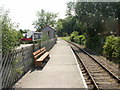
Lydney Town railway station platform
The view south towards the small shelter on the station platform, part of the heritage Dean Forest Railway. The station name sign at the other end of the platform has a different design http://www.geograph.org.uk/photo/1939036 from the one seen here.
Image: © Jaggery
Taken: 26 Jun 2010
0.02 miles
4
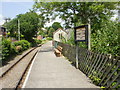
Old-style name sign, Lydney Town railway station
The style of the name sign at the southern end of the station differs from the one at the other end of the platform.http://www.geograph.org.uk/photo/1939031 My guess is that this one is the older design. The station is part of the heritage Dean Forest Railway.
Image: © Jaggery
Taken: 26 Jun 2010
0.02 miles
5
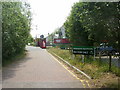
Entrance road to Queens Meadow Court from Hill Street, Lydney
Newly-built retirement bungalows and apartments on land directly south of Hill Street and parallel with the Dean Forest Railway line.
Image: © Jaggery
Taken: 26 Jun 2010
0.02 miles
6
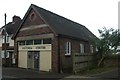
Lydney old fire station 2
Lydney old fire station 2, Victoria Road, Lydney, Gloucestershire, now the Victoria Centre, was built in 1933
Image: © Kevin Hale
Taken: 30 Apr 2010
0.03 miles
7
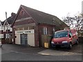
Victoria Centre, Lydney
Located in Victoria Road, The Victoria Centre is in the former Lydney Fire Station,vacated by the fire service in the mid 1970s. The stone inscription on the wall is LRDC 1933. LRDC = Lydney Rural District Council. The Victoria Centre is open for 49 weeks a year, run solely by volunteers. Regular users are more than 100 retired residents of Lydney and district for whom lunches, entertainment and occasional trips are available.
Image: © Jaggery
Taken: 1 Jan 2013
0.03 miles
8
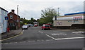
Victoria Road, Lydney
Viewed across Hill Street. For walkers and cyclists, this is a route to Bathurst Park Road and Bathurst Park.
In the distance, cars are parked near posts across the road which block access for motor vehicles.
The northeast edge of the High Street Tesco superstore http://www.geograph.org.uk/photo/3300904 is on the right.
Image: © Jaggery
Taken: 22 May 2016
0.04 miles
9
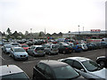
Supermarket Car Park, Lydney
The distant spire belongs to St. Mary's Church.
Image: © Pauline E
Taken: 11 Oct 2007
0.04 miles
10
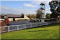
Yard behind Lydney Fire Station
Yard and rescue tower behind Lydney Fire Station.
Image: © Philip Halling
Taken: 25 Oct 2014
0.05 miles