IMAGES TAKEN NEAR TO
Upper Road, LYDNEY, GL15 4QZ

Introduction

This page details the photographs taken nearby to Upper Road, GL15 4QZ by members of the Geograph project.

The Geograph project started in 2005 with the aim of publishing, organising and preserving representative images for every square kilometre of Great Britain, Ireland and the Isle of Man.

There are currently over 7.5m images from over14,400 individuals and you can help contribute to the project by visiting https://www.geograph.org.uk

Image Map


Images are licensed for reuse under creativecommons.org/licenses/by-sa/2.0
Notes
  • Clicking on the map will re-center to the selected point.
  • The higher the marker number, the further away the image location is from the centre of the postcode.

Image Listing (29 Images Found)

Images are licensed for reuse under creativecommons.org/licenses/by-sa/2.0
  • ...
Image
Details
Distance
1
Pillowell Village Hall
Set back from Upper Road. Village Hall events shown on a notice: March 1st @ 7pm Skittles, £4 on the door, bring and share supper. March 29th @ 7pm Alan's Quiz £4 (ticket only event). Cheese and wine supplied for each table. April 5th @ 7pm Curry night. Free entrance, donations always gratefully accepted. Bring your own curry. We'll supply the rice and accompaniments. Come and meet your neighbours and help support your local Village Hall into the bargain. These evenings are always a bit of fun and healthy rivalry. Everybody is very welcome.
Image: © Jaggery Taken: 16 Mar 2014
0.06 miles
2
Old stone shed
By Upper Road, Yorkley
Image: © Jonathan Billinger Taken: 16 Sep 2020
0.06 miles
3
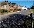
Main Road houses, Pillowell
Viewed from Upper Road.
Image: © Jaggery Taken: 16 Mar 2014
0.06 miles
4
Pillowell Village Hall
Situated in Upper Road, this was once a Co-op shop and bakery.
Image: © Pauline E Taken: 24 Jul 2008
0.06 miles
5
Woodlands Farm, Pillowell
Viewed from Upper Road looking towards Yorkley.
Image: © Jaggery Taken: 16 Mar 2014
0.07 miles
6
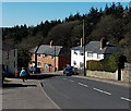
Main Road houses, Lower Yorkley
Viewed past the grey back of the Pillowell boundary sign. http://www.geograph.org.uk/photo/4417403
Image: © Jaggery Taken: 16 Mar 2014
0.09 miles
7
Down Main Road Yorkley towards Pillowell
In the Forest of Dean district of Gloucestershire, Main Road Yorkley descends towards Pillowell.
Image: © Jaggery Taken: 16 Mar 2014
0.09 miles
8
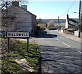
Northern boundary of Pillowell
In the Forest of Dean district of Gloucestershire, Main Road passes from Yorkley to Pillowell.
Image: © Jaggery Taken: 16 Mar 2014
0.09 miles
9
South side of Pillowell Methodist Church
Viewed from Upper Road, Pillowell. The inscription in stone on the building is PRIMITIVE METHODIST CHURCH 1885.
Image: © Jaggery Taken: 16 Mar 2014
0.09 miles
10
East side of Pillowell Methodist Church
Viewed from Upper Road, Pillowell. The inscription in stone on the building is PRIMITIVE METHODIST CHURCH 1885.
Image: © Jaggery Taken: 16 Mar 2014
0.09 miles
  • ...