IMAGES TAKEN NEAR TO
LYDNEY, GL15 4LP
Introduction
This page details the photographs taken nearby to GL15 4LP by members of the Geograph project.
The Geograph project started in 2005 with the aim of publishing, organising and preserving representative images for every square kilometre of Great Britain, Ireland and the Isle of Man.

There are currently over 7.5m images from over14,400 individuals and you can help contribute to the project by visiting https://www.geograph.org.uk
Image Map
Images are licensed for reuse under creativecommons.org/licenses/by-sa/2.0
Notes
- Clicking on the map will re-center to the selected point.
- The higher the marker number, the further away the image location is from the centre of the postcode.
Image Listing (8 Images Found)
Images are licensed for reuse under creativecommons.org/licenses/by-sa/2.0
Image
Details
Distance
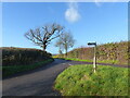
1
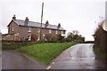
Row of cottages at Gurshill Farm
Turn left for Purton and right takes you to the A48 and Lydney.
Image: © Jonathan Billinger
Taken: 4 Dec 2006
0.01 miles
2
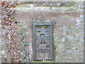
Ordnance Survey Flush Bracket G3931
This can be found on the wall of a house - a private dwelling - at Gurshill Farm.
For more detail see : http://www.bench-marks.org.uk/bm16008
Image: © Peter Wood
Taken: 16 Oct 2016
0.02 miles
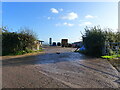
3
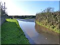
Evidence of much rainfall on the road by Gurshill Farm, Purton
Image: © Ruth Sharville
Taken: 25 Nov 2022
0.02 miles
4
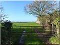
Gate, and view across a field, Gurshill Farm, near Purton
Image: © Ruth Sharville
Taken: 25 Nov 2022
0.02 miles
5
Junction of the lane to Wards Farm with the road to Purton
Image: © Ruth Sharville
Taken: 25 Nov 2022
0.03 miles
6
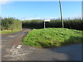
Road junction at Gurshill Farm
Looking north-eastward.
Image: © Peter Wood
Taken: 16 Oct 2016
0.04 miles
7
Farm activity and buildings, Gurshill Farm, Purton
Image: © Ruth Sharville
Taken: 25 Nov 2022
0.17 miles
8
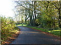
Bend, approaching a junction, on the road to Purton, near Lydney
Image: © Ruth Sharville
Taken: 25 Nov 2022
0.17 miles