
IMAGES TAKEN NEAR TO
Fancy Road, LYDNEY, GL15 4HU
Introduction
This page details the photographs taken nearby to Fancy Road, GL15 4HU by members of the Geograph project.
The Geograph project started in 2005 with the aim of publishing, organising and preserving representative images for every square kilometre of Great Britain, Ireland and the Isle of Man.

There are currently over 7.5m images from over14,400 individuals and you can help contribute to the project by visiting https://www.geograph.org.uk
Image Map
Images are licensed for reuse under creativecommons.org/licenses/by-sa/2.0
Notes
- Clicking on the map will re-center to the selected point.
- The higher the marker number, the further away the image location is from the centre of the postcode.
Image Listing (12 Images Found)
Images are licensed for reuse under creativecommons.org/licenses/by-sa/2.0
Image
Details
Distance
1
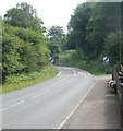
Northeast edge of Parkend
The speed limit changes from 30mph to the National Speed Limit as Fancy Road heads out of Parkend into the Forest of Dean. On the right are two sheep alongside a wall. In this area, sheep are a common sight on roadways. A nearby house has a cattle/sheep grid across its entrance drive. http://www.geograph.org.uk/photo/1937203
Image: © Jaggery
Taken: 26 Jun 2010
0.03 miles
2
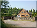
Cattle grid, easternmost house on Fancy Road, Parkend
Sheep wander freely in this part of the Forest of Dean, at the NE edge of Parkend.
This house, on the edge of the forest, has a cattle grid across its entrance drive.
Image: © Jaggery
Taken: 26 Jun 2010
0.03 miles
3
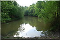
Brookways Ditch Lake
This is a very small Wildfowl Reserve, very close to the Fancy Road just before entering Parkend.
Image: © jeff collins
Taken: 22 May 2009
0.06 miles
4
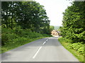
Fancy Road approaches Parkend
Nearing the end of its forest course, Fancy Road approaches the cleared section of the Forest of Dean occupied by Parkend village.
Ahead, to alert drivers to the lower speed limit in Parkend, there are white triangles http://www.geograph.org.uk/photo/1937263 painted on the road surface, on the approach to the 30mph speed limit sign.
Image: © Jaggery
Taken: 26 Jun 2010
0.06 miles
5
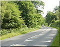
White triangles painted on road surface, Parkend
Looking along Fancy Road into the Forest of Dean from the NE edge of Parkend.
The white triangles alert drivers about to leave the forest that there is a 30mph speed limit in Parkend. The message is reinforced by a large 30 painted on a short stretch of pinkish road surface next to the 30mph sign, just behind the camera.
Image: © Jaggery
Taken: 26 Jun 2010
0.06 miles
6
Through the forest to Parkend
A few remnants of bluebells can still seen.
Image: © Pauline E
Taken: 20 May 2008
0.14 miles
7
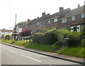
Fancy Road houses, Parkend
Houses on the southeast side of Fancy Road, between Woodland Road and Woodland Rise. There are no houses on the camera side of the road, which skirts the edge of the Forest of Dean.
Image: © Jaggery
Taken: 26 Jun 2010
0.16 miles
8
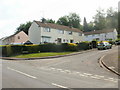
Woodland Rise, Parkend
The corner of Woodland Rise, viewed from Fancy Road. A short distance ahead, houses end as Fancy Road heads out of Parkend into the forest (of Dean).
Image: © Jaggery
Taken: 26 Jun 2010
0.16 miles
9
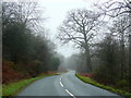
Fancy Road
Part of the Scenic Route from Blakeney looking towards Parkend.
Image: © Jonathan Billinger
Taken: 16 Dec 2009
0.21 miles
10
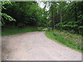
Track into the forest
One of hundreds of similar tracks criss-crossing the Forest of Dean.
Image: © Pauline E
Taken: 20 May 2008
0.22 miles