1
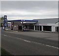
Hand Car Wash, Highfield Road, Lydney
Set back from the south side of Highfield Road near a Gulf filling station. http://www.geograph.org.uk/photo/5387860
Image: © Jaggery
Taken: 16 Apr 2017
0.01 miles
2
Thompson and Thompson, Lydney
Looking East across what was the old A48.
Image: © Stuart Wilding
Taken: 30 Mar 2006
0.02 miles
3
Cross Hands Garage Lydney
Gulf filling station alongside Highfield Road.
Image: © Jaggery
Taken: 16 Apr 2017
0.03 miles
4
Gulf garage at Cross Hands
On the eastern outskirts of Lydney.
Image: © M J Richardson
Taken: 24 Sep 2013
0.03 miles
5
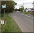
National Speed Limit signs, Highfield Road, Lydney
This part of Highfield Road is between the Driffield Road junction and the A48 junction out of shot ahead.
The entrance to a hand car wash http://www.geograph.org.uk/photo/5387846 is on the right.
Image: © Jaggery
Taken: 16 Apr 2017
0.04 miles
6
Highfield Road towards the A48, Lydney
From the corner of Driffield Road along Highfield Road towards the A48 junction out of shot ahead.
Image: © Jaggery
Taken: 16 Apr 2017
0.07 miles
7
P is for Parking, Highfield Road, Cross Hands, Lydney
Faded and stained in April 2017, a whitish P on a blue background
draws attention to the parking area extending for 60 metres ahead.
Image: © Jaggery
Taken: 16 Apr 2017
0.08 miles
8
Gated farm track off Highfield Road
Image: © JThomas
Taken: 17 Oct 2019
0.09 miles
9
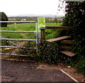
Highfield Road stile, Lydney
The stile gives walkers access to a track http://www.geograph.org.uk/photo/5387891 towards the A48 and Hurst Farm.
Image: © Jaggery
Taken: 16 Apr 2017
0.12 miles
10
Hilly field off Highfield Road
Image: © JThomas
Taken: 17 Oct 2019
0.12 miles


