
IMAGES TAKEN NEAR TO
Brookfields, LYDNEY, GL15 4BX
Introduction
This page details the photographs taken nearby to Brookfields, GL15 4BX by members of the Geograph project.
The Geograph project started in 2005 with the aim of publishing, organising and preserving representative images for every square kilometre of Great Britain, Ireland and the Isle of Man.

There are currently over 7.5m images from over14,400 individuals and you can help contribute to the project by visiting https://www.geograph.org.uk
Image Map
Images are licensed for reuse under creativecommons.org/licenses/by-sa/2.0
Notes
- Clicking on the map will re-center to the selected point.
- The higher the marker number, the further away the image location is from the centre of the postcode.
Image Listing (29 Images Found)
Images are licensed for reuse under creativecommons.org/licenses/by-sa/2.0
Image
Details
Distance
1
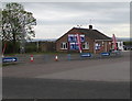
Hand Car Wash, Highfield Road, Lydney
Set back from the south side of Highfield Road near a Gulf filling station. http://www.geograph.org.uk/photo/5387860
Image: © Jaggery
Taken: 16 Apr 2017
0.08 miles
2
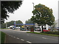
Gulf garage at Cross Hands
On the eastern outskirts of Lydney.
Image: © M J Richardson
Taken: 24 Sep 2013
0.09 miles
3
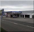
Cross Hands Garage Lydney
Gulf filling station alongside Highfield Road.
Image: © Jaggery
Taken: 16 Apr 2017
0.10 miles
4
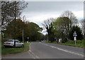
Highfield Road towards the A48, Lydney
From the corner of Driffield Road along Highfield Road towards the A48 junction out of shot ahead.
Image: © Jaggery
Taken: 16 Apr 2017
0.10 miles
5
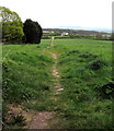
Track towards the A48 and Hurst Farm, Lydney
Viewed from the edge of Highfield Road.
Image: © Jaggery
Taken: 16 Apr 2017
0.10 miles
6
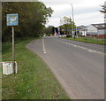
P is for Parking, Highfield Road, Cross Hands, Lydney
Faded and stained in April 2017, a whitish P on a blue background
draws attention to the parking area extending for 60 metres ahead.
Image: © Jaggery
Taken: 16 Apr 2017
0.11 miles
7
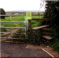
Highfield Road stile, Lydney
The stile gives walkers access to a track http://www.geograph.org.uk/photo/5387891 towards the A48 and Hurst Farm.
Image: © Jaggery
Taken: 16 Apr 2017
0.12 miles
8
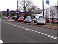
Thompson and Thompson, Lydney
Looking East across what was the old A48.
Image: © Stuart Wilding
Taken: 30 Mar 2006
0.12 miles
9
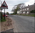
Warning sign - steep descent ahead, Highfield Road, Lydney
The sign indicates a 12% (between 1 in 8 and 1 in 9) descent ahead towards the town centre.
The black arrow on the Yorkley 2 (miles) sign points towards Driffield Road. http://www.geograph.org.uk/photo/5387701
Image: © Jaggery
Taken: 16 Apr 2017
0.12 miles
10
![Ink caps [Coprinus lagopus]](https://s3.geograph.org.uk/geophotos/03/68/31/3683147_40bed1e5_120x120.jpg)
Ink caps [Coprinus lagopus]
A common inkcap that often grows in association with wood and woodland litter - here it is on a heap of wood chippings by the road side. The spore producing caps last just for a day.
Image: © M J Richardson
Taken: 24 Sep 2013
0.13 miles