
IMAGES TAKEN NEAR TO
Dainty Street, GLOUCESTER, GL1 4UY
Introduction
This page details the photographs taken nearby to Dainty Street, GL1 4UY by members of the Geograph project.
The Geograph project started in 2005 with the aim of publishing, organising and preserving representative images for every square kilometre of Great Britain, Ireland and the Isle of Man.

There are currently over 7.5m images from over14,400 individuals and you can help contribute to the project by visiting https://www.geograph.org.uk
Image Map
Images are licensed for reuse under creativecommons.org/licenses/by-sa/2.0
Notes
- Clicking on the map will re-center to the selected point.
- The higher the marker number, the further away the image location is from the centre of the postcode.
Image Listing (48 Images Found)
Images are licensed for reuse under creativecommons.org/licenses/by-sa/2.0
Image
Details
Distance
1
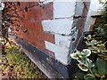
Ordnance Survey Cut Mark
This OS cut mark can be found on No63 Howard Street. It marks a point 16.563m above mean sea level.
Image: © Adrian Dust
Taken: 9 Jul 2022
0.05 miles
2
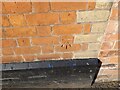
Ordnance Survey Cut Mark
This OS cut mark can be found on No102A High Street. It marks a point 17.825m above mean sea level.
Image: © Adrian Dust
Taken: 9 Jul 2022
0.10 miles
3
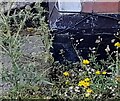
Ordnance Survey Cut Mark
This OS cut mark can be found on No35 Conduit Street. It marks a point 15.341m above mean sea level.
Image: © Adrian Dust
Taken: 9 Jul 2022
0.11 miles
4
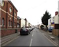
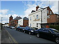
Falkner Street towards High Street Tredworth, Gloucester
Viewed from the corner of Conduit Street. The Trust Centre http://www.geograph.org.uk/photo/5187287 is on the left.
Image: © Jaggery
Taken: 6 Nov 2016
0.12 miles
6
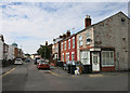
Ryecroft Street
A street of small terraced housing, like all the surrounding streets in this part of town.
Image: © Des Blenkinsopp
Taken: 29 Aug 2015
0.15 miles
7
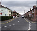
Howard Street, Gloucester
Viewed from the southern end of Midland Road.
Image: © Jaggery
Taken: 6 Nov 2016
0.15 miles
8
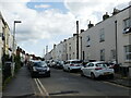
Ryecroft Street, Gloucester
The minaret of one of Gloucester's mosques showing above the houses.
Image: © Jonathan Thacker
Taken: 3 Oct 2023
0.15 miles
9
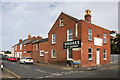
Sparkes Bakery
Former local bakery now an industrial premises to do with abrasives according to the notice on the front.
Image: © Des Blenkinsopp
Taken: 29 Aug 2015
0.15 miles
10
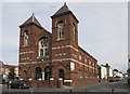
The Trust Centre, Victoria Street
Former church, now home to the All Nations Nursery.
Image: © Des Blenkinsopp
Taken: 29 Aug 2015
0.16 miles