1
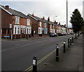
Conduit Street, Tredworth, Gloucester
Looking north across Tredworth Road.
Image: © Jaggery
Taken: 6 Nov 2016
0.05 miles
2
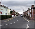
Furlong Road, Gloucester
The 30mph speed limit on Tredworth Road drops to 20 on Furlong Road.
Image: © Jaggery
Taken: 6 Nov 2016
0.07 miles
3
Corner of Furlong Road and Tredworth Road, Gloucester
Viewed across Tredworth Road near the corner of Stroud Road.
Image: © Jaggery
Taken: 6 Nov 2016
0.07 miles
4
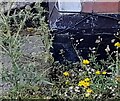
Ordnance Survey Cut Mark
This OS cut mark can be found on No35 Conduit Street. It marks a point 15.341m above mean sea level.
Image: © Adrian Dust
Taken: 9 Jul 2022
0.08 miles
5
Howard Street, Gloucester
Viewed from the southern end of Midland Road.
Image: © Jaggery
Taken: 6 Nov 2016
0.08 miles
6
Tredworth Road houses, Gloucester
The corner of Conduit Street http://www.geograph.org.uk/photo/5184834 is on the left.
Image: © Jaggery
Taken: 6 Nov 2016
0.08 miles
7
Stroud Road Garage, Gloucester
The garage at 151 Stroud Road provides vehicle servicing, repairs, diagnostics, MOTs etc.
Image: © Jaggery
Taken: 6 Nov 2016
0.09 miles
8
Ordnance Survey Cut Mark
This OS cut mark can be found on No11 Howard Street It marks a point 15.158m above mean sea level.
Image: © Adrian Dust
Taken: 9 Jul 2022
0.09 miles
9
Former Toll House, Stroud Road
At the junction with Tredworth Road. Believed to be a much modified ex Toll House, not much is obvious of the original building, though the footprint is very similar to that shown on the 1882/3 map. It would have served the Gloucester and Stroud Turnpike Trust up to the mid 19ᵗʰ Century.
Milestone Society National ID: GL.GLO02
Image: © Mr Red
Taken: 16 Dec 2022
0.09 miles
10
Stroud Road pillarbox and BT phonebox, Gloucester
Located near the corner of Tredworth Road. The pillarbox is Victorian. http://www.geograph.org.uk/photo/5185043
Image: © Jaggery
Taken: 6 Nov 2016
0.10 miles


