
IMAGES TAKEN NEAR TO
Buckshaft Road, CINDERFORD, GL14 3DL
Introduction
This page details the photographs taken nearby to Buckshaft Road, GL14 3DL by members of the Geograph project.
The Geograph project started in 2005 with the aim of publishing, organising and preserving representative images for every square kilometre of Great Britain, Ireland and the Isle of Man.

There are currently over 7.5m images from over14,400 individuals and you can help contribute to the project by visiting https://www.geograph.org.uk
Image Map
Images are licensed for reuse under creativecommons.org/licenses/by-sa/2.0
Notes
- Clicking on the map will re-center to the selected point.
- The higher the marker number, the further away the image location is from the centre of the postcode.
Image Listing (27 Images Found)
Images are licensed for reuse under creativecommons.org/licenses/by-sa/2.0
Image
Details
Distance
1
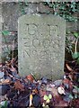
Modern Boundary Stone, Buckshaft Road
On the verge/berm against a wall, adjacent to 2 telephone poles, opposite house 1a.
It marks the boundary of the "Forest of Dean", in the parish of Ruspidge and Soudley.
Inscription: D. F. / 2008 / Nᴼ. 217
Milestone Society National ID: GL_DFRUSU217em
Image: © Mr Red
Taken: 6 Dec 2022
0.02 miles
2

The corner of Church Road with St White's Road, Ruspidge
There is an Ordnance Survey benchmark on the lighter coloured stone by the corner of the wall: Image
Image: © John S Turner
Taken: 11 Jun 2019
0.07 miles
3

Benchmark by Church Road/St White's Road junction, Ruspidge
Ordnance Survey benchmark on the stone wall by Church Road, Ruspidge. For a wider view see: Image
Benchmark Database: https://www.bench-marks.org.uk/bm237987
Image: © John S Turner
Taken: 11 Jun 2019
0.07 miles
4
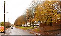
Conker trees along Ruspidge road, Forest of Dean
When the 'conkers' are ripe and fall these trees are very popular with the local small children. In the far distance is the T-junction of the Northern end of Ruspidge road with the East-West running Saint White's Road, which marks the Northern boundary of the parish of Ruspidge and Soudley.
Image: © Eric Soons
Taken: 9 Nov 2008
0.08 miles
5
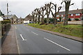
Ruspidge Road
Ruspidge Road junction with St Whites Road in Ruspidge.
Image: © Philip Halling
Taken: 25 Jan 2014
0.10 miles
6
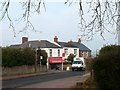
Bristol House Stores
Neighbourhood shop in Church Road.
Image: © Des Blenkinsopp
Taken: 9 Feb 2012
0.10 miles
7
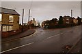
Church road junction, Cinderford, Forest of Dean
The Southern boundary of Cinderford is marked by Saint White's Road - this marks the start of Church road. Church road runs along the length of the Eastern ridge of North/South high ground upon which Cinderford is built. The Northern end of Church road ends at 'The Triangle' which is the centre of the town.
Image: © Eric Soons
Taken: 9 Nov 2008
0.10 miles
8
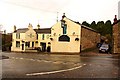
White Hart Inn, Cinderford, Forest of Dean
The White Hart Inn is sited about half way down the hill that comprises St. White's Road before it reaches the junction with Valley road at the road bridge over Cinderford brook.
Image: © Eric Soons
Taken: 9 Nov 2008
0.11 miles
10

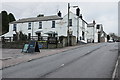
St White's Road, Ruspidge and a benchmark
The old stone wall alongside St White's Road has an Ordnance Survey benchmark on the third stone up. Image
This photo was taken in 2019 and it has been reported that by 2025 redevelopment has taken place and the wall has been demolished.
Image: © John S Turner
Taken: 11 Jun 2019
0.12 miles