
IMAGES TAKEN NEAR TO
Warwick Rise, CINDERFORD, GL14 3BG
Introduction
This page details the photographs taken nearby to Warwick Rise, GL14 3BG by members of the Geograph project.
The Geograph project started in 2005 with the aim of publishing, organising and preserving representative images for every square kilometre of Great Britain, Ireland and the Isle of Man.

There are currently over 7.5m images from over14,400 individuals and you can help contribute to the project by visiting https://www.geograph.org.uk
Image Map
Images are licensed for reuse under creativecommons.org/licenses/by-sa/2.0
Notes
- Clicking on the map will re-center to the selected point.
- The higher the marker number, the further away the image location is from the centre of the postcode.
Image Listing (27 Images Found)
Images are licensed for reuse under creativecommons.org/licenses/by-sa/2.0
Image
Details
Distance
1
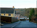
Hudson Lane, Ruspidge
The road descends the Soudley valley side down to the Ruspidge Road at the bottom.
Some new houses on the left have recently been completed.
Image: © Jonathan Billinger
Taken: 30 Nov 2009
0.04 miles
2
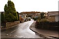
Hudson Lane, Ruspidge, Forest of Dean
Hudson Lane climbs up from Ruspidge road up a very steep hill to Buckshaft road at the top. After you have climbed up Hudson lane there are some spectacular views across the Ruspidge and Soudley valley and over the Forest to the West. To do the climb in one go you need to be quite fit - you will certainly get your morning's worth of cardio-vascular exercise !
Image: © Eric Soons
Taken: 10 Nov 2008
0.04 miles
3
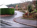
Buckshaft road and Dean View junction, Ruspidge, Forest of Dean
This is the junction of Dean view where it strikes off into Dean View. The Forest is immediately behind the back gardens of the houses on the right hand side of Dean View.
Image: © Eric Soons
Taken: 18 Nov 2008
0.05 miles
4
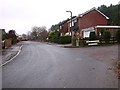
Linegar Wood Road junction, Ruspidge, Forest of Dean
This is the junction of Linegar Wood road from Dean View in Ruspidge.
Image: © Eric Soons
Taken: 18 Nov 2008
0.06 miles
5
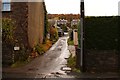
Kibbles Lane, Ruspidge, Forest of Dean
Almost immediately opposite Ruspidge Memorial Hall is this cul de sac. Although surfaced with tarmac after a fashion it is only wide enough for a small car. Ruspidge road, from where this photo was taken, runs North/South and this view is on the Eastern side of the road facing up the valley slope.
Image: © Eric Soons
Taken: 10 Nov 2008
0.08 miles
6
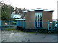
Buckshaft pumping station
A Severn-Trent facility at the end of Forest View, Ruspidge.
Typical Forest of Dean cottages stand beyond.
Image: © Jonathan Billinger
Taken: 30 Nov 2009
0.08 miles
7
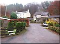
Linegar wood road, Ruspidge, Forest of Dean
Linegar wood road is a cul de sac which abuts against the Forest onto the spine of a wooded North/South hill.
Image: © Eric Soons
Taken: 18 Nov 2008
0.10 miles
8
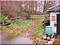
Forest entrance at Linegar wood road, Ruspidge, Forest of Dean
On the right hand side of Linegar wood road there is a muddy track that leads into the Forest and is the start of a walk along and down the spine of one side of the Ruspidge/Soudley valley.
Image: © Eric Soons
Taken: 18 Nov 2008
0.10 miles
9
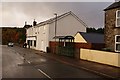
Ruspidge local shop, Forest of Dean
This, the shop with no-name, used to be Costcutters but currently has no name and is the sole remaining shop in the parish. The new bus stop is distinguished from most of the Forest bus stops by having the name of the provider (Ruspidge Parish Council) emblazoned on the gable ends. This view of Ruspidge road is facing South with the Forest, as ever, within sight.
Image: © Eric Soons
Taken: 9 Nov 2008
0.11 miles
10
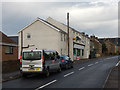
Ruspidge Road, Ruspidge
Looking towards Cinderford. The convenience store on the left appears to be unbranded but is in fact a Costcutter. Hudson Lane leads off on the right.
Image: © Stephen McKay
Taken: 11 Dec 2016
0.12 miles