IMAGES TAKEN NEAR TO
Edge Hills Road, CINDERFORD, GL14 2QR
Introduction
This page details the photographs taken nearby to Edge Hills Road, GL14 2QR by members of the Geograph project.
The Geograph project started in 2005 with the aim of publishing, organising and preserving representative images for every square kilometre of Great Britain, Ireland and the Isle of Man.

There are currently over 7.5m images from over14,400 individuals and you can help contribute to the project by visiting https://www.geograph.org.uk
Image Map
Images are licensed for reuse under creativecommons.org/licenses/by-sa/2.0
Notes
- Clicking on the map will re-center to the selected point.
- The higher the marker number, the further away the image location is from the centre of the postcode.
Image Listing (154 Images Found)
Images are licensed for reuse under creativecommons.org/licenses/by-sa/2.0
Image
Details
Distance
1
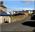
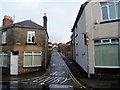
Heywood Road, Cinderford
North of the Trinity Way junction. http://www.geograph.org.uk/photo/4426864
Image: © Jaggery
Taken: 12 Apr 2015
0.08 miles
2
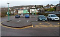
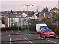
Heywood Road car park, Cinderford
The roughly L-shaped car park is handily placed, a couple of minutes' walk from High Street, Market Street and the town centre. At the December 2012 date of this view it was a pay car park Mondays-Saturdays, free all day Sunday.
Image: © Jaggery
Taken: 16 Dec 2012
0.09 miles
3
Trinity Way, Cinderford
From Heywood Road. The blue sign on the left shows Unsuitable for heavy goods vehicles.
Image: © Jaggery
Taken: 12 Apr 2015
0.10 miles
4
Pets Barn entrance, Cinderford
Viewed across Heywood Road. The yellow-on-green name board shows
Pets Barn Forest of Dean veterinary centre & animal hospital.
Image: © Jaggery
Taken: 16 Dec 2012
0.10 miles
5
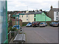
Heywood Road Car Park, Cinderford
Despite the Forest of Dean's many attractions, its main towns are workaday places and Cinderford is no exception. This is the car park on Heywood Road close to the town centre seen in the fading light of a December Sunday afternoon.
Image: © Stephen McKay
Taken: 11 Dec 2016
0.11 miles
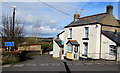
6
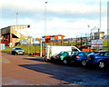
Car park in Heywood Road
There are two signs at the junction of Heywood Road and High Street, one Heywood Road, the other Haywood Road.
Image: © Pauline E
Taken: 17 Mar 2008
0.11 miles
7
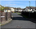
Westfield Court, Cinderford
Cul-de-sac on the north side of Westfield Road.
Image: © Jaggery
Taken: 12 Apr 2015
0.12 miles
8
The Beavis Memorial Ground, Cinderford
Viewed from the Dockham Road side. This is the home ground of Cinderford Rugby Football Club.
Image: © Jaggery
Taken: 16 Dec 2012
0.12 miles
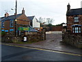
9
Woodgate Road, Cinderford
Viewed from High Street. The narrowness of the roadway makes in inevitable that there are double yellow lines (indicating no parking) on both sides of the road and that a one-way traffic system is in operation.
Image: © Jaggery
Taken: 16 Dec 2012
0.12 miles
10
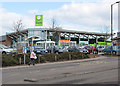
Co-op food store, Cinderford
Plans for a Tesco superstore and a new rugby club ground were approved by planners in 2005 and were then challenged by the Co-op which is next door to the proposed site for Tesco's new store.
Image: © Pauline E
Taken: 17 Mar 2008
0.12 miles