
IMAGES TAKEN NEAR TO
Oakwood Close, CINDERFORD, GL14 2QN
Introduction
This page details the photographs taken nearby to Oakwood Close, GL14 2QN by members of the Geograph project.
The Geograph project started in 2005 with the aim of publishing, organising and preserving representative images for every square kilometre of Great Britain, Ireland and the Isle of Man.

There are currently over 7.5m images from over14,400 individuals and you can help contribute to the project by visiting https://www.geograph.org.uk
Image Map
Images are licensed for reuse under creativecommons.org/licenses/by-sa/2.0
Notes
- Clicking on the map will re-center to the selected point.
- The higher the marker number, the further away the image location is from the centre of the postcode.
Image Listing (84 Images Found)
Images are licensed for reuse under creativecommons.org/licenses/by-sa/2.0
Image
Details
Distance
1
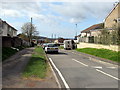
Edge Hills Road, Cinderford
From the Causeway Road junction.
Image: © Jaggery
Taken: 12 Apr 2015
0.04 miles
2
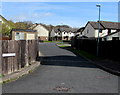
Westfield Court, Cinderford
Cul-de-sac on the north side of Westfield Road.
Image: © Jaggery
Taken: 12 Apr 2015
0.04 miles
3
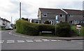
Wedgewood Crescent, Cinderford
At the northern edge of town, on the corner of Causeway Road and Edge Hills Road.
Image: © Jaggery
Taken: 12 Apr 2015
0.05 miles
4
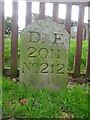
Boundary Stone, Cinderford
On the corner of Edge Hills Road and Causeway Road. Just to confuse, the houses above are addressed as being in Wedgewood Crescent. Including 9 and 10, clearly in Edge Hills Road.
Inscription: D.F. / 2011 / Nᴼ. 212
Milestone Society National ID: GL_DFCIND212em
Image: © Mr Red
Taken: 18 Nov 2022
0.07 miles
5
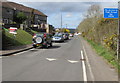
No access to High Street Cinderford for HGVs
Causeway Road west of the Edge Hills Road junction is not a route for heavy goods vehicles.
Image: © Jaggery
Taken: 12 Apr 2015
0.07 miles
6
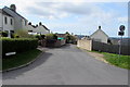
Northern end of Heywood Road, Cinderford
Looking south from Causeway Road along Heywood Road towards Cinderford town centre.
Image: © Jaggery
Taken: 12 Apr 2015
0.07 miles
7
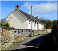
Heywood Road houses, Cinderford
Near the northern end of Heywood Road.
Image: © Jaggery
Taken: 12 Apr 2015
0.08 miles
8
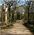
Dead tree and metal barrier at the southern edge of the Haywood Plantation, Cinderford
At a Causeway Road entrance to Forestry Commission land beyond the northern edge of residential Cinderford.
Walkers can enter the woods through the small gap in the barrier on the right.
Image: © Jaggery
Taken: 12 Apr 2015
0.08 miles
9
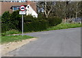
Vehicle weight restriction sign at the northern end of Heywood Road, Cinderford
At the T junction with Woodgate Road and Causeway Road.
Image: © Jaggery
Taken: 12 Apr 2015
0.08 miles
10
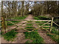
Gate across a path into the Haywood Plantation, Cinderford
The Forestry Commission initials FC are on the gate on the north side of Causeway Road,
at the northern edge of residential Cinderford. Walkers can bypass the gate on the left.
Image: © Jaggery
Taken: 12 Apr 2015
0.09 miles