IMAGES TAKEN NEAR TO
Meadow Road, CINDERFORD, GL14 2PX
Introduction
This page details the photographs taken nearby to Meadow Road, GL14 2PX by members of the Geograph project.
The Geograph project started in 2005 with the aim of publishing, organising and preserving representative images for every square kilometre of Great Britain, Ireland and the Isle of Man.

There are currently over 7.5m images from over14,400 individuals and you can help contribute to the project by visiting https://www.geograph.org.uk
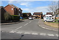
Image Map
Images are licensed for reuse under creativecommons.org/licenses/by-sa/2.0
Notes
- Clicking on the map will re-center to the selected point.
- The higher the marker number, the further away the image location is from the centre of the postcode.
Image Listing (93 Images Found)
Images are licensed for reuse under creativecommons.org/licenses/by-sa/2.0
Image
Details
Distance
1
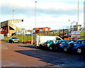
The Beavis Memorial Ground, Cinderford
Viewed from the Dockham Road side. This is the home ground of Cinderford Rugby Football Club.
Image: © Jaggery
Taken: 16 Dec 2012
0.08 miles
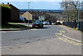
2
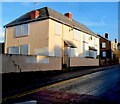
Boarded-up houses in Dockham Road, Cinderford
Two semis and the house behind were sealed up at the December 2012 date of this view.
Image: © Jaggery
Taken: 16 Dec 2012
0.12 miles
3
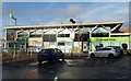
Cinderford Rugby Football Club, founded 1886
The Recreation Ground, Dockham Road. Soon to move to St. Whites Ground.
Image: © Pauline E
Taken: 17 Mar 2008
0.12 miles
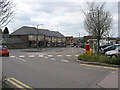
4
Co-operative Food, Travel and Cinderford post office
Set back from the north side of Dockham Road in Cinderford town centre.
Co-operative Travel and the post office are inside the food store.
Image: © Jaggery
Taken: 16 Dec 2012
0.13 miles
5
The Oak Field, Cinderford
Cul-de-sac on the west side of Littledean Hill Road.
Image: © Jaggery
Taken: 12 Apr 2015
0.14 miles
6
Latimer Road west of Forest View Primary School, Cinderford
The yellow road markings are near the school gates. http://www.geograph.org.uk/photo/4429092
Image: © Jaggery
Taken: 12 Apr 2015
0.14 miles
7
Outside Forest View School
You can see where they got the name from.
This is to the west of Littledean Hill Road, which has spectacular views eastwards out over the Severn Estuary from its route along the top of a ridge.
The views in this direction are not so obvious because that's where most of the housing is.
Image: © Des Blenkinsopp
Taken: 9 Feb 2015
0.15 miles
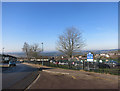
8
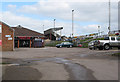
Bus station, Dockham Road, Cinderford
Next to the Co-op store, health centre and post office.
Image: © Pauline E
Taken: 17 Mar 2008
0.15 miles
9
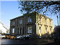
The Register Office, Cinderford
The former Police Station.
Image: © Jonathan Thacker
Taken: 10 Oct 2014
0.15 miles
10
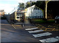
Cinderford Library
A white crossing painted on the road surface leads to the entrance of the Belle Vue Road library,
part of Gloucestershire County Council's library service.
Image: © Jaggery
Taken: 16 Dec 2012
0.15 miles