1
The Beavis Memorial Ground, Cinderford
Viewed from the Dockham Road side. This is the home ground of Cinderford Rugby Football Club.
Image: © Jaggery
Taken: 16 Dec 2012
0.09 miles
2
Cinderford: football ground
1-km square visited as part of the Gloucestershire Winter Bird Survey. A Bluett.
Image: © A Bluett
Taken: 5 Dec 2017
0.12 miles
3
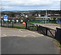
Latimer Road west of Forest View Primary School, Cinderford
The yellow road markings are near the school gates. http://www.geograph.org.uk/photo/4429092
Image: © Jaggery
Taken: 12 Apr 2015
0.14 miles
4
Outside Forest View School
You can see where they got the name from.
This is to the west of Littledean Hill Road, which has spectacular views eastwards out over the Severn Estuary from its route along the top of a ridge.
The views in this direction are not so obvious because that's where most of the housing is.
Image: © Des Blenkinsopp
Taken: 9 Feb 2015
0.14 miles
5
Cinderford Rugby Football Club, founded 1886
The Recreation Ground, Dockham Road. Soon to move to St. Whites Ground.
Image: © Pauline E
Taken: 17 Mar 2008
0.14 miles
6
Co-operative Food, Travel and Cinderford post office
Set back from the north side of Dockham Road in Cinderford town centre.
Co-operative Travel and the post office are inside the food store.
Image: © Jaggery
Taken: 16 Dec 2012
0.14 miles
7
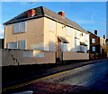
Boarded-up houses in Dockham Road, Cinderford
Two semis and the house behind were sealed up at the December 2012 date of this view.
Image: © Jaggery
Taken: 16 Dec 2012
0.16 miles
8
Co-op food store, Cinderford
Plans for a Tesco superstore and a new rugby club ground were approved by planners in 2005 and were then challenged by the Co-op which is next door to the proposed site for Tesco's new store.
Image: © Pauline E
Taken: 17 Mar 2008
0.16 miles
9
Primary school gates, Cinderford
At the southern (Latimer Road) edge of Forest View Primary School. http://www.geograph.org.uk/photo/4429086
Image: © Jaggery
Taken: 12 Apr 2015
0.16 miles
10
South side of Forest View Primary School, Cinderford
From Latimer Road.
Image: © Jaggery
Taken: 12 Apr 2015
0.16 miles


