
IMAGES TAKEN NEAR TO
Causeway Road, CINDERFORD, GL14 2AF
Introduction
This page details the photographs taken nearby to Causeway Road, GL14 2AF by members of the Geograph project.
The Geograph project started in 2005 with the aim of publishing, organising and preserving representative images for every square kilometre of Great Britain, Ireland and the Isle of Man.

There are currently over 7.5m images from over14,400 individuals and you can help contribute to the project by visiting https://www.geograph.org.uk
Image Map
Images are licensed for reuse under creativecommons.org/licenses/by-sa/2.0
Notes
- Clicking on the map will re-center to the selected point.
- The higher the marker number, the further away the image location is from the centre of the postcode.
Image Listing (37 Images Found)
Images are licensed for reuse under creativecommons.org/licenses/by-sa/2.0
Image
Details
Distance
1
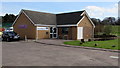
Forest of Dean Music Makers Cinderford SoundSpace
Located in Heywood Campus, Causeway Road. Forest of Dean Music Makers is an educational charity offering rehearsal and recording facilities at Cinderford SoundSpace as well as after-school clubs, workshops and other music activities.
Image: © Jaggery
Taken: 12 Apr 2015
0.00 miles
2
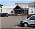
Cinderford Community Hub
Community centre in the Heywood Campus, Causeway Road, at the northern edge of Cinderford.
Image: © Jaggery
Taken: 12 Apr 2015
0.02 miles
3
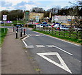
Traffic calming on Causeway Road, Cinderford
Approaching the 20mph maximum speed zone near the Forest High School. http://www.geograph.org.uk/photo/4430019
Image: © Jaggery
Taken: 12 Apr 2015
0.03 miles
4
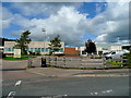
Heywood Campus 1
The site includes a Sports and Leisure Centre as well as the Community School which is a Sports College.
Viewed from Causeway Road.
Image: © Jonathan Billinger
Taken: 25 Aug 2009
0.04 miles
5
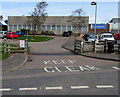
Keep Clear and sheep grid, Causeway Road, Cinderford
At the entrance to the Heywood Campus which includes the Forest High School http://www.geograph.org.uk/photo/4430019 and various sports and leisure facilities.
Image: © Jaggery
Taken: 12 Apr 2015
0.05 miles
6
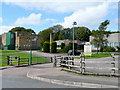
Heywood Campus 2
The site includes a Sports and Leisure Centre as well as the Community School which is a Sports College.
Viewed from Causeway Road.
Image: © Jonathan Billinger
Taken: 25 Aug 2009
0.09 miles
7
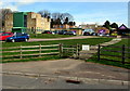
The Forest High School, Cinderford
On the north side of Causeway Road, at the northern edge of Cinderford.
Image: © Jaggery
Taken: 12 Apr 2015
0.09 miles
8
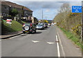
No access to High Street Cinderford for HGVs
Causeway Road west of the Edge Hills Road junction is not a route for heavy goods vehicles.
Image: © Jaggery
Taken: 12 Apr 2015
0.09 miles
9
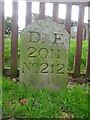
Boundary Stone, Cinderford
On the corner of Edge Hills Road and Causeway Road. Just to confuse, the houses above are addressed as being in Wedgewood Crescent. Including 9 and 10, clearly in Edge Hills Road.
Inscription: D.F. / 2011 / Nᴼ. 212
Milestone Society National ID: GL_DFCIND212em
Image: © Mr Red
Taken: 18 Nov 2022
0.09 miles
10
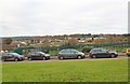
Cinderford: football ground
1-km square visited as part of the Gloucestershire Winter Bird Survey. A Bluett.
Image: © A Bluett
Taken: 5 Dec 2017
0.10 miles