IMAGES TAKEN NEAR TO
Rock Lane, WESTBURY-ON-SEVERN, GL14 1QF
Introduction
This page details the photographs taken nearby to Rock Lane, GL14 1QF by members of the Geograph project.
The Geograph project started in 2005 with the aim of publishing, organising and preserving representative images for every square kilometre of Great Britain, Ireland and the Isle of Man.

There are currently over 7.5m images from over14,400 individuals and you can help contribute to the project by visiting https://www.geograph.org.uk
Image Map
Images are licensed for reuse under creativecommons.org/licenses/by-sa/2.0
Notes
- Clicking on the map will re-center to the selected point.
- The higher the marker number, the further away the image location is from the centre of the postcode.
Image Listing (11 Images Found)
Images are licensed for reuse under creativecommons.org/licenses/by-sa/2.0
Image
Details
Distance
2
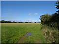
Footpath to White House Farm
Heading roughly north-west away from the A48 at Stantway House.
Image: © Jonathan Billinger
Taken: 15 Nov 2010
0.03 miles
4
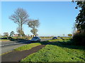
A48 at Stantway
Looking east towards Gloucester.
Image: © Jonathan Billinger
Taken: 15 Nov 2010
0.05 miles
5
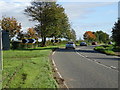
Sharp bend in the A48, Stantway
Towards Gloucester.
Image: © JThomas
Taken: 17 Oct 2019
0.05 miles
6
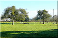
Old orchard at Stantway
The green on the old fruit trees is mistletoe.
The view of sheep in orchards is timeless.
Image: © Jonathan Billinger
Taken: 15 Nov 2010
0.08 miles
8
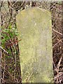
Old Milestone by the A48, Stantway, Westbury on Severn Parish
Carved stone post by the A48, in parish of WESTBURY ON SEVERN (FOREST OF DEAN District), 67m East of lane to Wintle's Hill House; adjacent to telephone pole D44, on grass verge, on North side of road. Elton stone, erected by the Elton (District of Huntley & Micheldean) turnpike trust in the 19th century.
Inscription reads:-
8
(MILE)S TO
(GLOUCE)STER
TO LONDON
113
Grade II listed. List Entry Number: 1299155
https://historicengland.org.uk/listing/the-list/list-entry/1299155
Milestone Society National ID: GL_GLNH08.
Image: © K Walker & R Harvey
Taken: 20 Feb 2002
0.19 miles