
IMAGES TAKEN NEAR TO
Church Lane, WESTBURY-ON-SEVERN, GL14 1NF
Introduction
This page details the photographs taken nearby to Church Lane, GL14 1NF by members of the Geograph project.
The Geograph project started in 2005 with the aim of publishing, organising and preserving representative images for every square kilometre of Great Britain, Ireland and the Isle of Man.

There are currently over 7.5m images from over14,400 individuals and you can help contribute to the project by visiting https://www.geograph.org.uk
Image Map
Images are licensed for reuse under creativecommons.org/licenses/by-sa/2.0
Notes
- Clicking on the map will re-center to the selected point.
- The higher the marker number, the further away the image location is from the centre of the postcode.
Image Listing (5 Images Found)
Images are licensed for reuse under creativecommons.org/licenses/by-sa/2.0
Image
Details
Distance
1
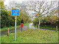
Three-way junction at Adsett
Church Lane, although clearly narrower, is the more direct route to Northwood Green.
The tree looks like a walnut.
Image: © Jonathan Billinger
Taken: 3 Nov 2011
0.03 miles
2
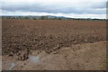
Ploughed field near Westbury-on-Severn
May Hill can be seen in the distance.
Image: © Philip Halling
Taken: 16 Mar 2013
0.18 miles
3
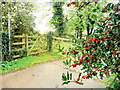
Holly berries at Adsett
This scene won't remain for long once the winter weather sets in.
Sign is for the footpath south-west towards Westbury.
Image: © Jonathan Billinger
Taken: 3 Nov 2011
0.19 miles
4
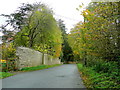
Adsett Lane
Autumnal scene heading north from Westbury.
Image: © Jonathan Billinger
Taken: 3 Nov 2011
0.19 miles
5
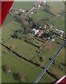
Adsett Court
The country house "a large 19th-century brick house" ('Westbury-on-Severn: Introduction', A History of the County of Gloucester: Volume 10: Westbury and Whitstone Hundreds (1972), pp. 79-85. URL: http://www.british-history.ac.uk/report.aspx?compid=15765 ), under repair after a recent fire, and the hamlet to its northeast.
Image: © Derek Harper
Taken: 21 Mar 2009
0.20 miles