
IMAGES TAKEN NEAR TO
Oldminster Road, BERKELEY, GL13 9UR
Introduction
This page details the photographs taken nearby to Oldminster Road, GL13 9UR by members of the Geograph project.
The Geograph project started in 2005 with the aim of publishing, organising and preserving representative images for every square kilometre of Great Britain, Ireland and the Isle of Man.

There are currently over 7.5m images from over14,400 individuals and you can help contribute to the project by visiting https://www.geograph.org.uk
Image Map
Images are licensed for reuse under creativecommons.org/licenses/by-sa/2.0
Notes
- Clicking on the map will re-center to the selected point.
- The higher the marker number, the further away the image location is from the centre of the postcode.
Image Listing (80 Images Found)
Images are licensed for reuse under creativecommons.org/licenses/by-sa/2.0
Image
Details
Distance
1

The top of the Sharpness Fundamental
Rare to find, a Fundamental Benchmark remains as a physical tool in the ever-increasingly digital surveying world. This one has kept its height tag, recording the monument at 113.90ft (34.716m).
Image: © Neil Owen
Taken: 5 Mar 2025
0.07 miles
2

Sharpness Fundamental
One of just over 200 such Fundamental Benchmarks, this O. S. monument occupies a pen near Luggs Farm. Unusually, this one has its height tag still evident, although with railings around it the overgrowth tends to take over. See https://www.bench-marks.org.uk/bm1146 for the entry in the Benchmark Database.
Image: © Neil Owen
Taken: 5 Mar 2025
0.07 miles
3

A pen by Luggs Farm
On the roadside opposite the farm is a metal pen. Inside is the Sharpness Fundamental Benchmark.
Image: © Neil Owen
Taken: 5 Mar 2025
0.07 miles
4
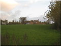
Luggs Farm
Would have been quite isolated before the developing of the Gloucester and Sharpness Canal and the coming of the railways and docks development.
Image: © Jonathan Thacker
Taken: 21 Nov 2013
0.10 miles
5

Little used on Oldminster Road
At the end of Sharpness village is a road junction that overlooks the docks. It seems this view is not one that is terribly popular.
Image: © Neil Owen
Taken: 5 Mar 2025
0.10 miles
7

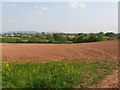
Junction at Oldminster Road
To the north of Newtown the main road fizzles out, but the junction carries on towards Brookend by turning at this junction. It is a completely average place but it holds a small feature - a Berntsen surveying point. See Image] for a closer look at the bins on the far side.
Image: © Neil Owen
Taken: 5 Mar 2025
0.10 miles
8
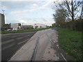
Tracks into Sharpness docks
Now they only go as far as the grass verge.
Image: © Jonathan Thacker
Taken: 21 Nov 2013
0.10 miles
9

A bucket, a bag and a Berntsen
Hidden among the roadside materials is a Berntsen. This unassuming circular cover protects an important surveying point. Close by is a Fundamental Benchmark, one of the few physical Ordnance Survey sites still in use, and this Berntsen is an auxiliary station to it.
Image: © Neil Owen
Taken: 5 Mar 2025
0.11 miles
10
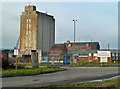
Sharpness Docks - gate No. 3
One of the entrances from the public road that passes the docks. The old warehouse in the background is a survivor from the docks' opening in the 1870s. A quiet Sunday afternoon in January was an ideal time for a walk around the publicly accessible parts of the docks.
Image: © Chris Allen
Taken: 13 Jan 2013
0.11 miles