
IMAGES TAKEN NEAR TO
The Docks, BERKELEY, GL13 9UN
Introduction
This page details the photographs taken nearby to The Docks, GL13 9UN by members of the Geograph project.
The Geograph project started in 2005 with the aim of publishing, organising and preserving representative images for every square kilometre of Great Britain, Ireland and the Isle of Man.

There are currently over 7.5m images from over14,400 individuals and you can help contribute to the project by visiting https://www.geograph.org.uk
Image Map
Images are licensed for reuse under creativecommons.org/licenses/by-sa/2.0
Notes
- Clicking on the map will re-center to the selected point.
- The higher the marker number, the further away the image location is from the centre of the postcode.
Image Listing (127 Images Found)
Images are licensed for reuse under creativecommons.org/licenses/by-sa/2.0
Image
Details
Distance
1

Boats and boatyards in Sharpness Docks
Plenty of trade in the docks and marina areas.
Image: © Neil Owen
Taken: 5 Mar 2025
0.03 miles
2
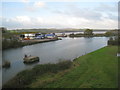
Boatyard and canal junction, Sharpness
The original canal ran behind the boatyard and is now a marina. The later canal giving entry to new larger docks is in the foreground.
Image: © Jonathan Thacker
Taken: 21 Nov 2013
0.03 miles
4
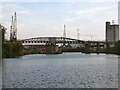
High & Low Level bridges, Sharpness Docks
Sharpness Docks developed after a new dock was constructed in 1870 to accommodate larger vessels which could not pass up the Gloucester & Sharpness canal. The railway lines which crossed these bridges connected to the Great Western and Midland network which provided an alternative to transportation by canal.
The photo was taken from the canal towpath.
Image: © Phil Champion
Taken: 21 Aug 2005
0.03 miles
5
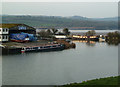
Sharpness Marine and the Gloucester & Sharpness Canal
The water to the left leads into Sharpness Docks. The Gloucester & Sharpness Canal passes across the end and over the wall is the River Severn. The shed is the business of Sharpness Marine.
Image: © Chris Allen
Taken: 13 Jan 2013
0.03 miles
6

A coloured block on the viaduct
Stopping larger vehicles, this block guards the old railway viaduct, now footpath.
Image: © Neil Owen
Taken: 5 Mar 2025
0.05 miles
7

Swing bridge on Sharpness Docks
With lots of rail links and the arrival of various sizes of vessels, a swing bridge is a necessity.
Image: © Neil Owen
Taken: 5 Mar 2025
0.05 miles
8
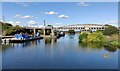
High Level Swing Bridge at Sharpness Docks
Image: © Mat Fascione
Taken: 24 Sep 2022
0.05 miles
9

Sharpness Docks from the canal side
Morning mist and a little bit of haze contribute to a monochrome impression.
Image: © Neil Owen
Taken: 5 Mar 2025
0.05 miles
10
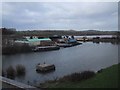
The Sharpness End of the Gloucester and Sharpness Canal
Image: © Sarah Charlesworth
Taken: 21 Nov 2008
0.05 miles