1
SW corner of Rigestate Industrial Estate near Berkeley
The industrial estate is near the site of Berkeley railway station http://www.geograph.org.uk/photo/1792122 where passenger services ceased in 1964.
Image: © Jaggery
Taken: 10 Mar 2013
0.02 miles
2
Entrance road to Rigestate Industrial Estate near Berkeley
Viewed from Station Road. The industrial estate is near the site of Berkeley railway station http://www.geograph.org.uk/photo/1792122
where passenger services ceased in 1964.
Image: © Jaggery
Taken: 10 Mar 2013
0.03 miles
3
Station access road, Berkeley
The station area is now an industrial estate.
Image: © nick macneill
Taken: 14 Oct 2012
0.03 miles
4
Former access road to Berkeley railway station
This unnamed side road heading NE formerly connected Station Road behind the camera with Berkeley railway station. http://www.geograph.org.uk/photo/1792122
Passengers services at the station ended in 1964.
Image: © Jaggery
Taken: 10 Mar 2013
0.05 miles
5
Berkeley Railway Station
Berkeley was the only intermediate station between Sharpness & the junction with the Bristol to Gloucester main line at Berkeley Road. It had opened in 1876 and closed to passengers in November 1964. In the background can be seen a gantry crane spanning a siding. This was used to transfer nuclear fuel rods from rail to road vehicles (& vice versa for the spent fuel rods) for use in the nearby Berkeley Nuclear Power station which had opened in 1962.
Image: © Martin Tester
Taken: Unknown
0.07 miles
6
Railway bridge side arch near Berkeley
This part of the bridge carries a railway line over a stream. The main part http://www.geograph.org.uk/photo/3364445 of the bridge is over Station Road.
Image: © Jaggery
Taken: 10 Mar 2013
0.07 miles
7
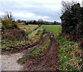
Muddy track into a field north of Berkeley
Viewed from the edge of this bridge http://www.geograph.org.uk/photo/3364445 looking towards a drainage channel. http://www.geograph.org.uk/photo/3365155
Image: © Jaggery
Taken: 10 Mar 2013
0.07 miles
8
A rail bridge on Station Road
Image: © Ian S
Taken: 5 Dec 2011
0.08 miles
9
Station Road railway bridge near Berkeley
The main arch of the bridge has conspicuous yellow and black stripes. Its headroom (overhead clearance) of 13 ft (3.0 metres) applies only to the middle of the road beneath the high point of the arch. The side arch http://www.geograph.org.uk/photo/3364480 on the right is over a stream. The identifier on the bridge is SAW 2M.29CH.
Berkeley railway station, which closed in 1964, was located a few ten of metres to the right (east) of the bridge.
Image: © Jaggery
Taken: 10 Mar 2013
0.08 miles
10
A field north of Berkeley in early spring
A view west from Station Road on March 10th 2013. Though meteorologically early spring, it felt like an unusually cold day in mid-winter, with a keen NE wind, overcast skies and midday temperature only about 2 degrees Celsius (mid 30s Fahrenheit).
The only certainty at this time of year is steadily increasing duration of daylight...
Image: © Jaggery
Taken: 10 Mar 2013
0.08 miles


