IMAGES TAKEN NEAR TO
Westgate Street, GLOUCESTER, GL1 2TP

Introduction

This page details the photographs taken nearby to Westgate Street, GL1 2TP by members of the Geograph project.

The Geograph project started in 2005 with the aim of publishing, organising and preserving representative images for every square kilometre of Great Britain, Ireland and the Isle of Man.

There are currently over 7.5m images from over14,400 individuals and you can help contribute to the project by visiting https://www.geograph.org.uk

Image Map


Images are licensed for reuse under creativecommons.org/licenses/by-sa/2.0
Notes
  • Clicking on the map will re-center to the selected point.
  • The higher the marker number, the further away the image location is from the centre of the postcode.

Image Listing (1896 Images Found)

Images are licensed for reuse under creativecommons.org/licenses/by-sa/2.0
  • ...
Image
Details
Distance
1
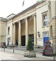
Gloucestershire Shire Hall
Gloucestershire County Council offices in Westgate Street. The portico with its ionic columns (1816) was designed by Robert Smirke. www.gloucestershire.gov.uk
Image: © Colin Smith Taken: 31 Jul 2019
0.00 miles
2
Shire Hall
Gloucester's centre of power, located in Westgate Street. For the keener viewer there is a flush bracket on a prominent stone on the steps to the entrance. See Image] for a look at this easily-overlooked benchmark.
Image: © Neil Owen Taken: 11 Aug 2012
0.01 miles
3
Detail of Shire Hall, Westgate Street, Gloucester
Robert Smirke's Ionic portico (1815-16). Little else of his building survives. Wider view Image
Image: © Stephen Richards Taken: 17 May 2015
0.01 miles
4
Coat of arms of Gloucestershire, Shire Hall, Gloucester
The emblem refers to the county's traditional wool and iron industries as represented by hanging fleeces and horseshoes. The motto is Prorsum Semper, "ever forward".
Image: © Rudi Winter Taken: 16 Mar 2019
0.01 miles
5
Shire Hall, Westgate Street
Image: © David Dixon Taken: 26 Jul 2010
0.01 miles
6
Shire Hall
Westgate Street.
Image: © David Dixon Taken: 26 Jul 2010
0.01 miles
7
Shirehall in Gloucester on National Armed Forces Day 2012
Image: © Roger Davies Taken: 30 Jun 2012
0.01 miles
8
Ordnance Survey Flush Bracket (333)
This OS flush bracket can be found on the front of the Shire Hall. It marks a point 15.232m above mean sea level.
Image: © Adrian Dust Taken: 9 Jul 2022
0.01 miles
9
Gloucester - Westgate Street
A flag-bedecked pedestrianised street in Gloucester city centre. www.visitgloucester.co.uk
Image: © Colin Smith Taken: 31 Jul 2019
0.01 miles
10
Westgate Street
A view eastwards along one of Gloucester's historic old roads.
Image: © Neil Owen Taken: 11 Aug 2012
0.01 miles
  • ...