
IMAGES TAKEN NEAR TO
Pincots Lane, WOTTON-UNDER-EDGE, GL12 8NY
Introduction
This page details the photographs taken nearby to Pincots Lane, GL12 8NY by members of the Geograph project.
The Geograph project started in 2005 with the aim of publishing, organising and preserving representative images for every square kilometre of Great Britain, Ireland and the Isle of Man.

There are currently over 7.5m images from over14,400 individuals and you can help contribute to the project by visiting https://www.geograph.org.uk
Image Map
Images are licensed for reuse under creativecommons.org/licenses/by-sa/2.0
Notes
- Clicking on the map will re-center to the selected point.
- The higher the marker number, the further away the image location is from the centre of the postcode.
Image Listing (13 Images Found)
Images are licensed for reuse under creativecommons.org/licenses/by-sa/2.0
Image
Details
Distance
1
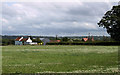
2011 : South of east from the B4060 Sodbury Road
A field of mowing grass with white clover about ready for the farmer.
Looking toward Hill View Farm and Pincot's Farm, the south western Cotswold escarpment is in the background.
Image: © Maurice Pullin
Taken: 21 Jun 2011
0.12 miles
2

2011 : Entrance to Pincots Farm
Seen from the B4060 Sodbury Road.
There is a more salubrious way in via Hill View Farm.
For those interested in such things the Somerset Monument at Hawkesbury Upton sits on the horizon extreme right Image
Image: © Maurice Pullin
Taken: 21 Jun 2011
0.12 miles
3
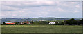
2011 : North of east from the B4060
Looking across a wheatfield toward Pincots Farm. The western Cotswold escarpment is in the distance above Hillesley and Alderley.
A post office tower stands on the horizon at Image
Image: © Maurice Pullin
Taken: 21 Jun 2011
0.13 miles
4
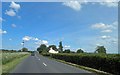
B4060 Sodbury Road near Pincots Farm Wickwar
Image: © Steve Fareham
Taken: 21 May 2014
0.14 miles
5
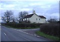
Pincots Lane
This isolated house stands at the junction with the B4060.
Image: © Roger Cornfoot
Taken: 27 Jan 2007
0.14 miles
6
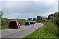
2011 : B4060 Sodbury Road near Wickwar
A little short of a mile out of Wickwar heading south for Chipping Sodbury, three and a half miles to go.
Image: © Maurice Pullin
Taken: 21 Jun 2011
0.14 miles
7
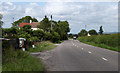
2011 : B4060 Sodbury Road looking north
One mile to Wickwar.
Peter's Cottages is - or are - ahead, with Fernleigh in the distance.
Image: © Maurice Pullin
Taken: 21 Jun 2011
0.18 miles
8
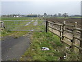
Pincots Farm
A relatively new but clearly infrequently-used drive directly to the farm from the B4060 Sodbury Road. A footpath feeds off to the right across an uninviting ploughed field.
Image: © Jonathan Billinger
Taken: 30 Mar 2007
0.19 miles
9
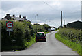
2011 : Frith Lane, seen from the B4060
No heavy vehicles, except for loading.
Rangeworthy on the B4058 in about two and a half miles.
Image: © Maurice Pullin
Taken: 21 Jun 2011
0.20 miles
10
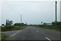
Wickwar Road heading north into Wickwar
The turning into Frith Lane can be seen on the left, and the name signs for Wickwar are also visible in the distance.
Image: © Ruth Riddle
Taken: 18 May 2012
0.21 miles