
IMAGES TAKEN NEAR TO
The Buthay, WOTTON-UNDER-EDGE, GL12 8NW
Introduction
This page details the photographs taken nearby to The Buthay, GL12 8NW by members of the Geograph project.
The Geograph project started in 2005 with the aim of publishing, organising and preserving representative images for every square kilometre of Great Britain, Ireland and the Isle of Man.

There are currently over 7.5m images from over14,400 individuals and you can help contribute to the project by visiting https://www.geograph.org.uk
Image Map
Images are licensed for reuse under creativecommons.org/licenses/by-sa/2.0
Notes
- Clicking on the map will re-center to the selected point.
- The higher the marker number, the further away the image location is from the centre of the postcode.
Image Listing (22 Images Found)
Images are licensed for reuse under creativecommons.org/licenses/by-sa/2.0
Image
Details
Distance
1
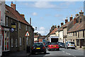
2011 : B4060 High Street, Wickwar
Mostly old and venerable buildings from before the 19th century.
The "Majestic" is not a cinema, it is a delivery van.
Image: © Maurice Pullin
Taken: 21 Jun 2011
0.06 miles
3
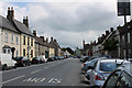
2011 : B4060 south on Wickwar High Street
Apart from the road and the traffic little has changed here in the last 200 years.
Think I can see a phone box.
Image: © Maurice Pullin
Taken: 21 Jun 2011
0.07 miles
4
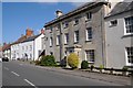
Georgian houses, Wickwar
Georgian houses on Wickwar's High Street.
Image: © Philip Halling
Taken: 26 Sep 2015
0.09 miles
5
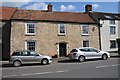
House on Wickwar High Street
House on Wickwar High Street built in the local stone.
Image: © Philip Halling
Taken: 26 Sep 2015
0.09 miles
6
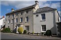
Georgian house, Wickwar
A Georgian house on Wickwar's High Street.
Image: © Philip Halling
Taken: 26 Sep 2015
0.09 miles
7
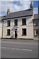
House on Wickwar High Street
House on Wickwar High Street with a grand portico.
Image: © Philip Halling
Taken: 26 Sep 2015
0.10 miles
8
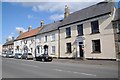
Houses and Wickwar Social Club
Houses along with Wickwar Social Club on Wickwar's High Street.
Image: © Philip Halling
Taken: 26 Sep 2015
0.11 miles
9
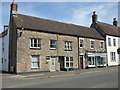
Bread history in Wickwar
The house on the corner was the old bakery, the place next door was the Baker's Cottage.
Image: © Neil Owen
Taken: 13 May 2019
0.12 miles
10
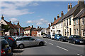
2011 : B4060 Wickwar High Street
Looking north, the sign of the Red Lion marks then Wickwar Social Club.
"The place-name 'Wickwar' is first attested in the Domesday Book of 1086, where it appears as 'Wichen', meaning 'dairy farm or settlement'. The manor was given to John la Warre by King John and was held by Roger la Warre in 1285, when it was referred to as 'Warre Wyke'. Warre is a Norman family name which gave its name to Wickwar.
The village originally lay on the Old Saltway from Droitwich to Chipping Sodbury and Pucklechurch, and was developed in the late 13th century by the de la Warre family with the establishment of a market in 1285. The main street, the present High Street, was laid out around the market place with uniform burgage plots and rear access lanes. Burghers paid an annual fixed rent to the overlord, but they could sell their tenancies much as in the free market today. In addition they often carried on trades and crafts which, together with their property rights, distinguished them from the feudal peasant. Livestock were often kept on the burgage plots behind the house, and this necessitated the rear access lane.
The original settlement of Wickwar was located around the church and Poole Court, a 16th-century Manor House demolished in the 19th century, to the north of the village. All that remains of the Manor is its terraced garden, south-west of the church, which formerly stood on the edge of a lake. The Parish Church of the Holy Trinity is set on a small hill and is of 12th-century origin. It was extensively remodelled in the 14th and 15th centuries and was restored c.1881 by W L Bernard. Inside there is an interesting sculpture of St John the Baptist dated 1496, which was originally housed at Poole Court."
The above was copied from Wikipedia.
http://en.wikipedia.org/wiki/Wickwar
Image: © Maurice Pullin
Taken: 21 Jun 2011
0.12 miles