
IMAGES TAKEN NEAR TO
Michaelwood, WOTTON-UNDER-EDGE, GL12 8HA
Introduction
This page details the photographs taken nearby to GL12 8HA by members of the Geograph project.
The Geograph project started in 2005 with the aim of publishing, organising and preserving representative images for every square kilometre of Great Britain, Ireland and the Isle of Man.

There are currently over 7.5m images from over14,400 individuals and you can help contribute to the project by visiting https://www.geograph.org.uk
Image Map
Images are licensed for reuse under creativecommons.org/licenses/by-sa/2.0
Notes
- Clicking on the map will re-center to the selected point.
- The higher the marker number, the further away the image location is from the centre of the postcode.
Image Listing (8 Images Found)
Images are licensed for reuse under creativecommons.org/licenses/by-sa/2.0
Image
Details
Distance
1
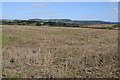
Stubble field near Michaelwood Lodge Farm
View to the east over a stubble field near Michaelwood Lodge Farm, the farm is out of sight just below the brow of the field. The Cotswolds Hills are on the horizon.
Image: © Philip Halling
Taken: 26 Sep 2015
0.05 miles
2
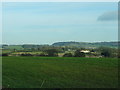
Field at Damery
This field is by the gateway to the lands of Michaelwood Lodge Farm. The farm itself is divided in two by the main Bristol to Gloucester railway, and the farmhouse, which may be seen in the middle distance, can only be reached from this point by passing under the line where it bridges the long entrance track.
Image: © Ruth Riddle
Taken: 28 Jan 2012
0.05 miles
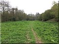
4
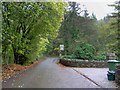
Weak bridge ahead
Restricted weight bridge crossing the Little Avon river.
Image: © Steve Fareham
Taken: 11 Nov 2009
0.18 miles
5
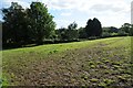
Field near Damery
Field adjacent to the Little Avon River near the village of Tortworth.
Image: © Philip Halling
Taken: 26 Sep 2015
0.19 miles
6
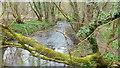
The Little Avon at Damery
This watercourse has nothing to do with the nearby Avon of Bristol and Bath.
Image: © Jonathan Billinger
Taken: 9 Mar 2012
0.21 miles
7
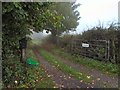
Damery Woodpeckers
This lane at Damery leads down to the Little Avon river, but appears to be the drive to a private house.
Image: © Roger May
Taken: 19 Oct 2005
0.23 miles
8
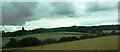
Fields viewed from railway line
Looking towards Damery. Michaelwood Cottage just visible in middle of picture (below trees). There are earthwork remains of an old castle between this and the building to the left.
Image: © Clint Mann
Taken: 3 Sep 2015
0.23 miles