IMAGES TAKEN NEAR TO
Ozleworth, WOTTON-UNDER-EDGE, GL12 7PX
Introduction
This page details the photographs taken nearby to GL12 7PX by members of the Geograph project.
The Geograph project started in 2005 with the aim of publishing, organising and preserving representative images for every square kilometre of Great Britain, Ireland and the Isle of Man.

There are currently over 7.5m images from over14,400 individuals and you can help contribute to the project by visiting https://www.geograph.org.uk
Image Map
Images are licensed for reuse under creativecommons.org/licenses/by-sa/2.0
Notes
- Clicking on the map will re-center to the selected point.
- The higher the marker number, the further away the image location is from the centre of the postcode.
Image Listing (10 Images Found)
Images are licensed for reuse under creativecommons.org/licenses/by-sa/2.0
Image
Details
Distance
1
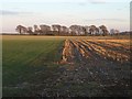
New and old crop near Symonds' Hall Farm
The junction of a winter crop sprouting and the remnants of last year's stubble as seen from the lane north of Ozleworth. The line of trees is in Image
Image: © Derek Harper
Taken: 2 Jan 2010
0.12 miles
4
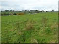
Farmland near Symonds' Hall Farm
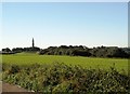
View over farmland to Symonds' Hall Farm.
Image: © Philip Halling
Taken: 27 Oct 2016
0.16 miles
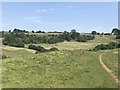
7

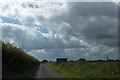
Minor road with passing places
This narrow minor road has regular designated passing places, labelled as such to deter anyone from parking in them whilst taking a walk to enjoy the nearby views down into Tyley Bottom.
Image: © Ruth Riddle
Taken: 3 Mar 2012
0.20 miles
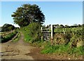
8
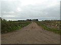
Access road to Symonds Hall Farm near Uley
Image: © nick macneill
Taken: 14 Oct 2012
0.21 miles
9
Road to Ozleworth
The minor road is signposted as the route to Newark Park. On the skyline is a communications mast in Image The sign is the advance direction sign for the junction with the A4135
Image: © David Smith
Taken: 28 Jul 2012
0.23 miles
10
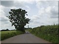
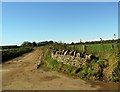
Field entrance and lone tree on road to Ozleworth
The entrance on the left also serves as a passing place
Image: © David Smith
Taken: 15 Jun 2018
0.24 miles