
IMAGES TAKEN NEAR TO
Bowcott, WOTTON-UNDER-EDGE, GL12 7EL
Introduction
This page details the photographs taken nearby to GL12 7EL by members of the Geograph project.
The Geograph project started in 2005 with the aim of publishing, organising and preserving representative images for every square kilometre of Great Britain, Ireland and the Isle of Man.

There are currently over 7.5m images from over14,400 individuals and you can help contribute to the project by visiting https://www.geograph.org.uk
Image Map
Images are licensed for reuse under creativecommons.org/licenses/by-sa/2.0
Notes
- Clicking on the map will re-center to the selected point.
- The higher the marker number, the further away the image location is from the centre of the postcode.
Image Listing (7 Images Found)
Images are licensed for reuse under creativecommons.org/licenses/by-sa/2.0
Image
Details
Distance
1
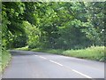
B4058 near The Ridge
A tree-lined section of the road.
Image: © Ruth Riddle
Taken: 9 Jun 2012
0.11 miles
2
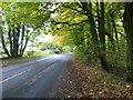
The B4058 passing The Ridge
The B4058, Tetbury to Wotton-under-Edge road, passing The Ridge.
Image: © Philip Halling
Taken: 27 Oct 2016
0.12 miles
3
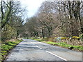
The B4058 after a shower
This is the Wotton to Tetbury road.
Image: © David Collins
Taken: 29 Mar 2007
0.14 miles
4
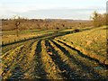
Track near The Ridge
This track, its ruts emphasised by the low afternoon sun, is followed by footpath CWE/2/2.
Image: © Derek Harper
Taken: 2 Jan 2010
0.16 miles
5
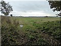
Farmland above Tyley Bottom
The radio mast at Goose Green can be seen on the horizon to the left.
Image: © Philip Halling
Taken: 27 Oct 2016
0.17 miles
6
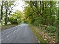
The B4058 passing Cotswold Edge Golf Club
The B4058, the road between Tetbury and Wotton-under-Edge, passing Cotswold Edge Golf Club.
Image: © Philip Halling
Taken: 27 Oct 2016
0.21 miles
7
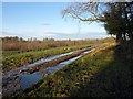
Frozen track above Tumbleyhill Wood
Frozen puddles close to a running icy stream on footpath CWE/2/1. Tumbleyhill Wood is across the field to the left, on the steeper slope down into Waterley Bottom.
Image: © Derek Harper
Taken: 2 Jan 2010
0.23 miles