
IMAGES TAKEN NEAR TO
Stancombe, DURSLEY, GL11 6AU
Introduction
This page details the photographs taken nearby to GL11 6AU by members of the Geograph project.
The Geograph project started in 2005 with the aim of publishing, organising and preserving representative images for every square kilometre of Great Britain, Ireland and the Isle of Man.

There are currently over 7.5m images from over14,400 individuals and you can help contribute to the project by visiting https://www.geograph.org.uk
Image Map
Images are licensed for reuse under creativecommons.org/licenses/by-sa/2.0
Notes
- Clicking on the map will re-center to the selected point.
- The higher the marker number, the further away the image location is from the centre of the postcode.
Image Listing (13 Images Found)
Images are licensed for reuse under creativecommons.org/licenses/by-sa/2.0
Image
Details
Distance
1
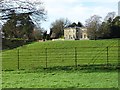
Stancombe Park
View to Stancombe Park a fine house according to Pevsner, originally built around 1815-20 for PB Purnell, and rebuilt in 1886 after a fire. The house is Grade II listed, https://historicengland.org.uk/listing/the-list/list-entry/1090874 however, the listing dates the original house to around 1840. Pevsner also reports this was the site of an extensive Roman Villa, fragments of which can be seen in Gloucester City Museum.
Image: © Philip Halling
Taken: 18 Jan 2020
0.01 miles
2
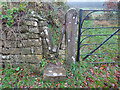
Stone Stile, Stinchcombe
Looking from Park Lane. The view looking out is Image
Image: © Mr Red
Taken: 14 Dec 2021
0.05 miles
3
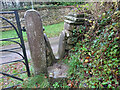
Stone Stile, Stinchcombe
Looking out to Park Lane. The view looking in is Image
Image: © Mr Red
Taken: 14 Dec 2021
0.05 miles
4
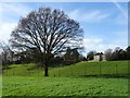
View to Stancombe Park
View to Stancombe Park a fine house according to Pevsner, originally built around 1815-20 for PB Purnell, and rebuilt in 1886 after a fire. The house is Grade II listed, https://historicengland.org.uk/listing/the-list/list-entry/1090874 however, the listing dates the original house to around 1840. Pevsner also reports this was the site of an extensive Roman Villa, fragments of which can be seen in Gloucester City Museum.
Image: © Philip Halling
Taken: 18 Jan 2020
0.10 miles
5
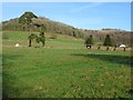
Stinchcombe Hill
Stinchcombe Hill, part of the Cotswolds escarpment viewed from Stancombe Park.
Image: © Philip Halling
Taken: 18 Jan 2020
0.12 miles
6
Minor road to Stancombe, Gloucestershire
Image: © nick macneill
Taken: 14 Oct 2012
0.13 miles
7

Park Lane, Stinchcombe
Park Lane, a country road in Stinchcombe. In this picture Stinchcombe Hill can be seen in the background.
Image: © Philip Halling
Taken: 18 Jan 2020
0.14 miles
8
Direction finger post in green junction near Stancombe Park
Image: © Steve Fareham
Taken: 27 Oct 2014
0.15 miles
9
A green traffic island
A large green triangle traffic island where the country road named Ivy Cottages meets the B4060.
Image: © Philip Halling
Taken: 18 Jan 2020
0.15 miles
10

View to the Tyndale Monument
View to the Tyndale Monument from Stinchcombe. Monument is in memory of William Tyndale who in the early 16th century translated the bible into English.
Image: © Philip Halling
Taken: 18 Jan 2020
0.16 miles