
IMAGES TAKEN NEAR TO
Trotman Avenue, DURSLEY, GL11 5RE
Introduction
This page details the photographs taken nearby to Trotman Avenue, GL11 5RE by members of the Geograph project.
The Geograph project started in 2005 with the aim of publishing, organising and preserving representative images for every square kilometre of Great Britain, Ireland and the Isle of Man.

There are currently over 7.5m images from over14,400 individuals and you can help contribute to the project by visiting https://www.geograph.org.uk
Image Map
Images are licensed for reuse under creativecommons.org/licenses/by-sa/2.0
Notes
- Clicking on the map will re-center to the selected point.
- The higher the marker number, the further away the image location is from the centre of the postcode.
Image Listing (18 Images Found)
Images are licensed for reuse under creativecommons.org/licenses/by-sa/2.0
Image
Details
Distance
1
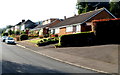
Fairmead, Cam
Houses in Fairmead, located on the south side of Cam Pitch (the A4135).
Image: © Jaggery
Taken: 7 Oct 2012
0.11 miles
2
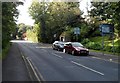
Cam Pitch, Cam
The A4135, here named Cam Pitch, climbs away from High Street and Chapel Street in the centre of Cam. The sign on the right shows 1½ miles to Dursley, 5 miles to Wotton-under-Edge.
Image: © Jaggery
Taken: 7 Oct 2012
0.13 miles
3
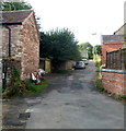
Spouthouse Lane, Cam
Viewed from the Chapel Street/Station Road end. I didn't investigate whether the spouthouse still existed, partly because I don't exactly know what a spouthouse is.
There are at least two other Spouthouse Lanes in England.
One is in Accrington. http://www.geograph.org.uk/photo/2054313 The other one is in Great Barr. http://www.geograph.org.uk/photo/39497
Image: © Jaggery
Taken: 7 Oct 2012
0.20 miles
4
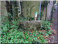
Stone Stile, Elstub Lane
The remains of a slab stile. Cam have numbered their Stone Stiles, this is number 13. It has a companion stone because this is at a cross roads of footpaths (see the long shot Image). This is the Eastern (LH) of the two. For Cam's list of Stone Stiles see https://www.camparishcouncil.gov.uk/uploads/april-2021-stone-stiles-in-cam.pdf .
Image: © Mr Red
Taken: 3 Dec 2021
0.20 miles
5
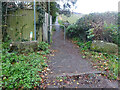
Two Stone Stiles, Elstub Lane
The remains of a slab stile. Cam have numbered their Stone Stiles, this is probably number 13a, but there is no plaque to indicate. It has a companion stone because this is at a cross roads of footpaths (see the LH stone Image). For Cam's list of Stone Stiles see https://www.camparishcouncil.gov.uk/uploads/april-2021-stone-stiles-in-cam.pdf .
Image: © Mr Red
Taken: 3 Dec 2021
0.20 miles
6
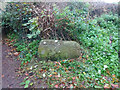
Stone Stile, Elstub Lane
The remains of a slab stile. Cam have numbered their Stone Stiles, it does not have a plaque but is probably number 13a. It has a companion stone (Image) because this is at a cross roads of footpaths (see the long shot Image). This is the Western (RH) of the two. For Cam's list of Stone Stiles see https://www.camparishcouncil.gov.uk/uploads/april-2021-stone-stiles-in-cam.pdf .
Image: © Mr Red
Taken: 3 Dec 2021
0.20 miles
7

Lower Cam Parish Church
St Bartholomew's Church, built in 1844.
Image: © David Dixon
Taken: 29 Feb 2012
0.21 miles
8
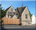
St Bartholomew's Church Hall, Cam
Mid 19th century building in Cam Pitch, to the SE of the church. http://www.geograph.org.uk/photo/3173221
Image: © Jaggery
Taken: 7 Oct 2012
0.22 miles
9
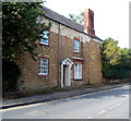
Former bakehouse and post office, Cam
Now a private residence, 22 Chapel Street's previous uses include post office and bakehouse.
The larger ground floor window on the right is part of the former shop front.
Image: © Jaggery
Taken: 7 Oct 2012
0.22 miles
10
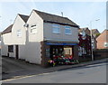
Sunflowers Florist, Cam
Located in Chapel Street, near the southern end of High Street.
Image: © Jaggery
Taken: 7 Oct 2012
0.22 miles