IMAGES TAKEN NEAR TO
Cam, DURSLEY, GL11 5HU
Introduction
This page details the photographs taken nearby to GL11 5HU by members of the Geograph project.
The Geograph project started in 2005 with the aim of publishing, organising and preserving representative images for every square kilometre of Great Britain, Ireland and the Isle of Man.

There are currently over 7.5m images from over14,400 individuals and you can help contribute to the project by visiting https://www.geograph.org.uk
Image Map
Images are licensed for reuse under creativecommons.org/licenses/by-sa/2.0
Notes
- Clicking on the map will re-center to the selected point.
- The higher the marker number, the further away the image location is from the centre of the postcode.
Image Listing (23 Images Found)
Images are licensed for reuse under creativecommons.org/licenses/by-sa/2.0
Image
Details
Distance
1
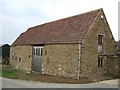
Fieldlane Farm
Roadside barn made of traditional stone with a double roman tiled roof
Image: © Symon Parsley
Taken: 25 Mar 2007
0.00 miles
2
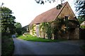
Barn conversion at FieldLane Farm
Barn conversion at FieldLane Farm on Field Lane near Lower Cam.
Image: © Philip Halling
Taken: 26 Sep 2015
0.01 miles
3
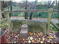
Stone Stile, Field Lane
On the Eastern side of Field Lane, high on the bank. This is the view from the field, the view from the road is Image For Cam's list of Stone Stiles see https://www.camparishcouncil.gov.uk/uploads/april-2021-stone-stiles-in-cam.pdf .
Image: © Mr Red
Taken: 3 Dec 2021
0.05 miles
4
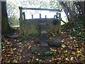
Stone Stile, Field Lane
On the Eastern side of Field Lane, high on the bank. This is the view from the road, the view from the field is Image For Cam's list of Stone Stiles see https://www.camparishcouncil.gov.uk/uploads/april-2021-stone-stiles-in-cam.pdf .
Image: © Mr Red
Taken: 3 Dec 2021
0.05 miles
5
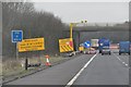
South Gloucestershire : M5 Motorway Northbound
Approaching roadworks and one of those annoying 50mph average speed check areas on the motorway.
Image: © Lewis Clarke
Taken: 6 Feb 2012
0.15 miles
6
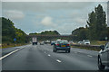
Cam : M5 Motorway
The M5 Motorway between Junction 14 (Falfield) and Junction 13 (Stroudwater).
Image: © Lewis Clarke
Taken: 22 Sep 2019
0.16 miles
7
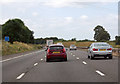
M5 north west of Cam
At Marker A109.5
Image: © J.Hannan-Briggs
Taken: 30 Jul 2014
0.16 miles
8
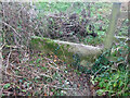
Stone Stile Cam
First field boundary West from Field Lane, looking SW. For the view looking NE see Image For Cam's list of Stone Stiles see https://www.camparishcouncil.gov.uk/uploads/april-2021-stone-stiles-in-cam.pdf .
Image: © Mr Red
Taken: 3 Dec 2021
0.16 miles
9
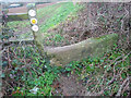
Stone Stile Cam
First field boundary West from Field Lane, looking NE. For the view looking SW see Image For Cam's list of Stone Stiles see https://www.camparishcouncil.gov.uk/uploads/april-2021-stone-stiles-in-cam.pdf .
Image: © Mr Red
Taken: 3 Dec 2021
0.16 miles