
IMAGES TAKEN NEAR TO
Drake Lane, DURSLEY, GL11 5HB
Introduction
This page details the photographs taken nearby to Drake Lane, GL11 5HB by members of the Geograph project.
The Geograph project started in 2005 with the aim of publishing, organising and preserving representative images for every square kilometre of Great Britain, Ireland and the Isle of Man.

There are currently over 7.5m images from over14,400 individuals and you can help contribute to the project by visiting https://www.geograph.org.uk
Image Map
Images are licensed for reuse under creativecommons.org/licenses/by-sa/2.0
Notes
- Clicking on the map will re-center to the selected point.
- The higher the marker number, the further away the image location is from the centre of the postcode.
Image Listing (56 Images Found)
Images are licensed for reuse under creativecommons.org/licenses/by-sa/2.0
Image
Details
Distance
1
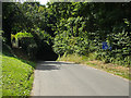
Drake Lane - steep hill ahead
Drake Lane at the top of a steep (double chevron) descent down to Dursley.
Image: © Phil Champion
Taken: 20 Aug 2005
0.03 miles
2
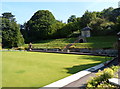
Structures on the eastern side of the bowling green, Dursley Bowls Club
Steps lead up from the bowling green to an arched structure and a small building behind it.
Image: © Jaggery
Taken: 21 Jul 2012
0.07 miles
3
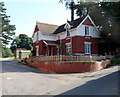
Drake Lane house, Dursley
Located on the east side of Drake House. http://www.geograph.org.uk/photo/3052696
Image: © Jaggery
Taken: 21 Jul 2012
0.09 miles
4
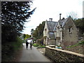
The Cotswold Way at Dursley
The Cotswold Way, day three 5:01pm
Image: © Ian S
Taken: 19 Apr 2013
0.09 miles
5
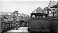
Dursley station, with branch train from Coaley, 1950
View SE to buffer-stops. The locomotive is ex-Midland 0-6-0T No. 41720, its crew are resting on a seat. The station closed 10/9/62 to passengers, goods 1/11/66, when the branch was closed. (See also Image).
Image: © Walter Dendy, deceased
Taken: 2 Sep 1950
0.10 miles
6
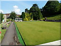
Bowling green, Dursley Bowls Club
The bowling green is about 40 metres long and 25 metres wide.
Image: © Jaggery
Taken: 21 Jul 2012
0.10 miles
7
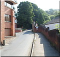
Drake Lane, Dursley
Drake Lane climbs away from the edge of Drake House. http://www.geograph.org.uk/photo/3052696
Image: © Jaggery
Taken: 21 Jul 2012
0.10 miles
8
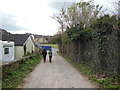
Heading towards Long Street, Dursley
The Cotswold Way, day three 5:02pm
Image: © Ian S
Taken: 19 Apr 2013
0.12 miles
9
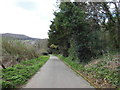
The Cotswold Way in Dursley
The Cotswold Way, day three 5:00pm
Image: © Ian S
Taken: 19 Apr 2013
0.12 miles
10
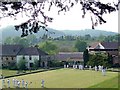
Dursley Bowls Club
Formed as R.A.Lister Bowling Club in 1949 as a section of the works Social Club, it is now renamed and open for membership to all local residents. This was formerly the site of a private garden to "The Priory" and contains a listed 18th C.gazebo. The Cotswold Way passes the club.
Image: © John Mackriell
Taken: 29 Apr 2007
0.12 miles