
IMAGES TAKEN NEAR TO
Shadwell, DURSLEY, GL11 5BW
Introduction
This page details the photographs taken nearby to Shadwell, GL11 5BW by members of the Geograph project.
The Geograph project started in 2005 with the aim of publishing, organising and preserving representative images for every square kilometre of Great Britain, Ireland and the Isle of Man.

There are currently over 7.5m images from over14,400 individuals and you can help contribute to the project by visiting https://www.geograph.org.uk
Image Map
Images are licensed for reuse under creativecommons.org/licenses/by-sa/2.0
Notes
- Clicking on the map will re-center to the selected point.
- The higher the marker number, the further away the image location is from the centre of the postcode.
Image Listing (13 Images Found)
Images are licensed for reuse under creativecommons.org/licenses/by-sa/2.0
Image
Details
Distance
1
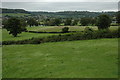
View to Stouts Hill
View to Stouts Hill and the village of Uley from the south-west.
Image: © Philip Halling
Taken: 5 Sep 2009
0.17 miles
3
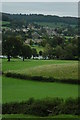
Stouts Hill
Stouts Hill is a holiday centre which is situated in the valley near the village of Uley. Here it is viewed from the south-west with Uley in the background.
Image: © Philip Halling
Taken: 5 Sep 2009
0.20 miles
4
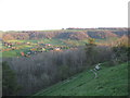
Uleybury seat in the evening - Uley, Gloucestershire
Looking out over the Uley valley from the ramparts of Uleybury, an Iron Age hill fort sited just off the B4066 Stroud - Dursley road. This Geographer spent 30 happy years living in Gloucestershire and returning to Stroud for a few days and revisiting this place reminds me very sharply of all those years now past, opportunities untaken, bittersweet memories of love and loss. Towards the centre of the photo is Stoutshill, built in 1743 to the design of William Halfpenny - in 1935 it became Stouts Hill Boys School and in 1980 was sold for conversion to timeshare use. Time taken photo 7.34 pm BST (British Summer Time).
Image
Image
Image: © Martin Richard Phelan
Taken: 15 Apr 2014
0.21 miles
5
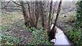
The diminutive River Ewelme
A Cotswolds stream south of Uley which feeds into the Cam and thence helps support the Gloucester Canal.
Image: © Jonathan Billinger
Taken: 12 Dec 2019
0.21 miles
7
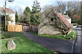
Lampern Hill, Uley
The stone bottom left marks the site of a former village sheep wash that was later adapted to wash cars and subsequently filled in.
Image: © Chris Allen
Taken: 10 Mar 2019
0.23 miles
8
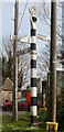
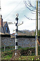
Old Direction Sign - Signpost by the B4066, The Street, Uley Parish
Annulus finial - 4 arms; Gloucestershire concrete by the B4066, in parish of Uley (Stroud District), The Street, junction with Fop Street, lower end of village.
Surveyed
Milestone Society National ID: GL_ST7897
Image: © Milestone Society
Taken: Unknown
0.23 miles
10
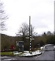
Communications on the edge of Uley
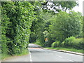
Crossroads with access to the valley to the south and a modern estate to the north, letter box and telephone box
Image: © David Smith
Taken: 29 Dec 2017
0.24 miles