1
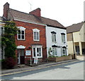
Dursley Library
The building, designed by Ridge Architects, was opened in February 2006. In the foreground is May Lane.
Image: © Derek Harper
Taken: 5 May 2007
0.01 miles
2
The Dursley Day Centre
The May Lane day centre is located opposite Dursley bus station. http://www.geograph.org.uk/photo/3315486 The board on the pavement asks Are you over 60? Then do come in for tea, coffee or a soft drink or light refreshments, all available at reasonable prices.
Image: © Jaggery
Taken: 21 Jul 2012
0.01 miles
3
Butterfly mural, Dursley
The mural is on a fence at the edge of a long derelict May Lane site. http://www.geograph.org.uk/photo/3315939
Image: © Jaggery
Taken: 21 Jul 2012
0.01 miles
4
A long derelict corner site, Dursley
This corner of May Lane and Prospect Place has been derelict for decades.
11/11A May Lane are a pair of Victoria terraced houses acquired by Stroud District Council in 1976. The properties have been vacant for a considerable period of time because of a combination of factors. A proposal in 2008 that the site should either be converted for use as a youth centre, or sold on the open market for development has apparently been shelved.
Image: © Jaggery
Taken: 21 Jul 2012
0.01 miles
5
Mary Lane, Dursley and the end of day three
The Cotswold Way, day three 5:34pm
Image: © Ian S
Taken: 19 Apr 2013
0.01 miles
6
Dursley Library, May Street
The modern library building on May Lane was opened in 2006. It replaced the 1936-built library which had stood on the same site until demolished in 2005.
Image: © David Dixon
Taken: 29 Feb 2012
0.01 miles
7
The Lions Den, Dursley
The Lions Club of Dursley, chartered in 1981, now has more than 30 members.
It meets here at the Lion's Den in May Lane. In addition to the Lions, Dursley has a Lioness Club whose members are also active in the community. Since its charter, the Dursley Lions Club has become a prominent organisation in the area, raising money for charities and other funded groups through events such as the weekly furniture sale and the Frocester Beer Festival.
Image: © Jaggery
Taken: 21 Jul 2012
0.02 miles
8
Dursley Library
The modern library building on May Lane was opened in 2006. It replaced the 1936-built library which had stood on the same site until demolished in 2005.
Image: © David Dixon
Taken: 29 Feb 2012
0.02 miles
9
Dursley library
Image: © Ruth Sharville
Taken: 28 Jul 2012
0.02 miles
10
Old Spot Inn name sign, Dursley
The sign depicting a Gloucestershire Old Spot hangs from a post on the May Lane side of this inn. http://www.geograph.org.uk/photo/3315396
Image: © Jaggery
Taken: 21 Jul 2012
0.02 miles


