
IMAGES TAKEN NEAR TO
May Lane, DURSLEY, GL11 4HU
Introduction
This page details the photographs taken nearby to May Lane, GL11 4HU by members of the Geograph project.
The Geograph project started in 2005 with the aim of publishing, organising and preserving representative images for every square kilometre of Great Britain, Ireland and the Isle of Man.

There are currently over 7.5m images from over14,400 individuals and you can help contribute to the project by visiting https://www.geograph.org.uk
Image Map
Images are licensed for reuse under creativecommons.org/licenses/by-sa/2.0
Notes
- Clicking on the map will re-center to the selected point.
- The higher the marker number, the further away the image location is from the centre of the postcode.
Image Listing (116 Images Found)
Images are licensed for reuse under creativecommons.org/licenses/by-sa/2.0
Image
Details
Distance
1
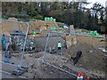
Gabion retaining structure
Large gabions containing Cotswold stone built high in order to protect the new build on a steep hillside.
Image: © don cload
Taken: 22 Nov 2022
0.07 miles
2
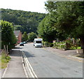
May Lane south of Hill Road, Dursley
Looking towards Five Acres.
Image: © Jaggery
Taken: 21 Jul 2012
0.08 miles
3
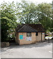
Public toilets, May Lane car park, Dursley
The car park is on the corner of May Lane and Hill Road.
Image: © Jaggery
Taken: 21 Jul 2012
0.12 miles
4
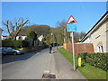
Hill Road, Dursley
The Cotswold Way, day four 8:32am
Image: © Ian S
Taken: 20 Apr 2013
0.12 miles
5
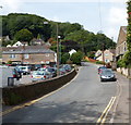
Hill Road, Dursley
Viewed from alongside The Old Spot Inn http://www.geograph.org.uk/photo/3315396 looking west past a car park towards the Hardings Drive junction.
Image: © Jaggery
Taken: 21 Jul 2012
0.12 miles
7
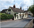
The Old Spot Inn, Dursley
Viewed across Hill Road. The Old Spot is on the corner of May Lane.
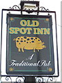
The name sign http://www.geograph.org.uk/photo/3315402 shows the type of Old Spot that gave the inn its name.
Image: © Jaggery
Taken: 21 Jul 2012
0.13 miles
8
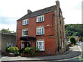
Grade II listed Hollis House, Dursley
Now in use as offices, this 3-storey building at 21 May Lane on the corner of The Slade
was built as a detached house c1840. Grade II listed in March 1983.
A plaque http://www.geograph.org.uk/photo/3315929 on the corner of the building records the early history of Dursley.
Image: © Jaggery
Taken: 21 Jul 2012
0.13 miles
9
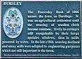
Dursley plaque, Hollis House, Dursley
The plaque is fixed to the wall on the corner of Hollis House. http://www.geograph.org.uk/photo/3315928
Image: © Jaggery
Taken: 21 Jul 2012
0.13 miles
10
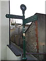
It's 8:30am on day four and time to get walking
The Cotswold Way, day four 8:30am
Image: © Ian S
Taken: 20 Apr 2013
0.13 miles