
IMAGES TAKEN NEAR TO
Lister Road, DURSLEY, GL11 4FH
Introduction
This page details the photographs taken nearby to Lister Road, GL11 4FH by members of the Geograph project.
The Geograph project started in 2005 with the aim of publishing, organising and preserving representative images for every square kilometre of Great Britain, Ireland and the Isle of Man.

There are currently over 7.5m images from over14,400 individuals and you can help contribute to the project by visiting https://www.geograph.org.uk
Image Map
Images are licensed for reuse under creativecommons.org/licenses/by-sa/2.0
Notes
- Clicking on the map will re-center to the selected point.
- The higher the marker number, the further away the image location is from the centre of the postcode.
Image Listing (60 Images Found)
Images are licensed for reuse under creativecommons.org/licenses/by-sa/2.0
Image
Details
Distance
1
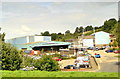
Listers, Dursley
Known locally only as Listers, this is the home of Lister-Petter, manufacturers of diesel engines. Founded in 1867, Listers merged with Petters in 1986. Listers first made diesel engines here in 1929 and sent them all over the Empire. The distinctive phut-phut can still be heard all over the world as their products last forever. Much reduced in scale now, they are still leading players with worldwide distribution.
Image: © Philip Pankhurst
Taken: 20 Aug 2013
0.06 miles
2
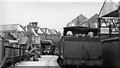
Dursley station, with branch train from Coaley, 1950
View SE to buffer-stops. The locomotive is ex-Midland 0-6-0T No. 41720, its crew are resting on a seat. The station closed 10/9/62 to passengers, goods 1/11/66, when the branch was closed. (See also Image).
Image: © Walter Dendy, deceased
Taken: 2 Sep 1950
0.09 miles
4
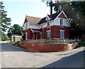
Drake Lane house, Dursley
Located on the east side of Drake House. http://www.geograph.org.uk/photo/3052696
Image: © Jaggery
Taken: 21 Jul 2012
0.14 miles
5

More development in Dursley
Both homes and business space are being advertised on the site of a former mill.
Image: © Bill Boaden
Taken: 18 Jul 2016
0.14 miles
6
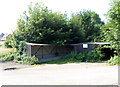
Bicycle shelter, Dursley
Located at the southern edge of a parking area near Drake House. http://www.geograph.org.uk/photo/3052696
Image: © Jaggery
Taken: 21 Jul 2012
0.14 miles
7
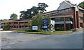
Drake House, Dursley
Office building, Drake Lane.
Image: © Jaggery
Taken: 21 Jul 2012
0.14 miles
8
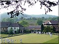
Dursley Bowls Club
Formed as R.A.Lister Bowling Club in 1949 as a section of the works Social Club, it is now renamed and open for membership to all local residents. This was formerly the site of a private garden to "The Priory" and contains a listed 18th C.gazebo. The Cotswold Way passes the club.
Image: © John Mackriell
Taken: 29 Apr 2007
0.15 miles
9
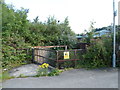
Danger deep water keep out, Dursley
The yellow notice is on a fence at the southern edge of Littlecombe Business Park.
Image: © Jaggery
Taken: 21 Jul 2012
0.15 miles
10
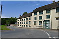
'The Priory', Long Street, Dursley
Part of a Grade II Listed building http://www.britishlistedbuildings.co.uk/101290900-the-priory-dursley#.WYef6_-Wy70
Image: © Tim Heaton
Taken: 6 Jul 2017
0.15 miles